 Filter: Categories of Wisconsin Historical Images
Filter: Subject of Land
Filter: Year of 2000-Present
Filter: Categories of Wisconsin Historical Images
Filter: Subject of Land
Filter: Year of 2000-Present

| Date: | 2004 |
|---|---|
| Description: | Holstein cows resting on a sunny day in a hilltop pasture. View to horizon towards wooded hills with clouds in the sky. |

| Date: | 07 2001 |
|---|---|
| Description: | David Obey poses with Park Ranger Geoffrey Smith on the left and Martin Hanson on the right. They are standing on the beach with water and land in the back... |
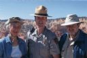
| Date: | 05 2005 |
|---|---|
| Description: | Joan Obey, Ranger Brent McGinn and Congressman David Obey at Bryce Canyon National Park. Canyon walls are in the far background. |
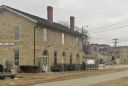
| Date: | 02 23 2012 |
|---|---|
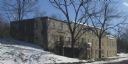
| Description: | Exterior view of the railroad depot building. |
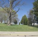
| Date: | 04 25 2012 |
|---|---|
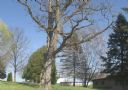
| Description: | A view of the approach to the Village of Blue Mounds from the cemetery. |

| Date: | 2003 |
|---|---|
| Description: | The front of map shows trails throughout the bottom half of Wisconsin and includes text on snowmobile rules and tourism contacts. The reverse shows trails ... |
| Date: | 03 20 2012 |
|---|---|
| Description: | An empty lot, which is the former site of the Cornish Primitive Methodist Episcopal Church. |
| Date: | 06 23 2012 |
|---|---|
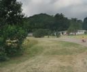
| Description: | A house built on the former site of Mill's Saloon, which was next to Loddis Mill. A little girl is riding a tricycle up the street. |
| Date: | 03 20 2012 |
|---|---|
| Description: | An empty lot with trees. This is the former site of the Cornish Primitive Methodist Episcopal Church. |
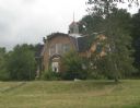
| Date: | 02 16 2012 |
|---|---|
| Description: | Exterior view, with snow on the ground, of the Walker House on 1 Water Street. The stone house functions as a guest house/hotel. |
| Date: | 04 03 2012 |
|---|---|
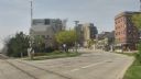
| Description: | View down East Wilson Street across the railroad tracks towards condominiums and businesses on the 400 block, including the Cardinal Bar & Cafe at 418 East... |
| Date: | 2013 |
|---|---|
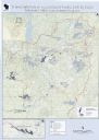
| Description: | This map shows hydroelectric dams, natural-lake and man-made reservoirs, the Wisconsin River and its tributaries, and the Wisconsin River Drainage Basin. T... |

| Date: | 2000 |
|---|---|
| Description: | This map shows national parks, county and state forests, Indian reservations, municipal land, private land, docks, boat access, camping, and points of inte... |
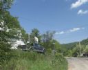
| Date: | 07 30 2012 |
|---|---|
| Description: | A view up a street, with a house and truck on the right. |
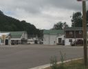
| Date: | 07 27 2012 |
|---|---|
| Description: | A view down Main Street in Beetown on an overcast day. |
| Date: | 07 27 2012 |
|---|---|
| Description: | Exterior view of the public school, positioned on a small hill. |
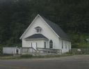
| Date: | 07 27 2012 |
|---|---|
| Description: | Exterior view of the Methodist Evangelical Church, with stairs and a ramp at the front of the building. |

| Date: | 04 19 2012 |
|---|---|
| Description: | A view of the downtown area on a rainy day. The Woodford State Bank is on the left, and the street is lined with various storefronts and taverns. There is ... |

| Date: | 02 25 2012 |
|---|---|
| Description: | A view of Blanchardville through trees, from a hill above the school. |

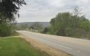
| Date: | 04 19 2012 |
|---|---|
| Description: | View towards the curve of Darlington Road when approaching Blanchardville. |
If you didn't find the material you searched for, our Library Reference Staff can help.
Call our reference desk at 608-264-6535 or email us at: