 Filter: Categories of Wisconsin Historical Images
Filter: Subject of Land
Filter: Year of 1900-1999
Filter: Type of Map or Atlas
Filter: Categories of Wisconsin Historical Images
Filter: Subject of Land
Filter: Year of 1900-1999
Filter: Type of Map or Atlas

| Date: | 1908 |
|---|---|
| Description: | Colored map showing a panoramic view of Madison in great detail. The Wisconsin State Capitol is located at the center, with Lake Mendota in the background ... |

| Date: | 1926 |
|---|---|
| Description: | Map of the routes of the screw-driven passenger/freight vessels of the Michigan Transit Company for 1926. |

| Date: | 1907 |
|---|---|
| Description: | Bird's-eye map of Chippewa Falls with insets of Chippewa Lumber & Boom Co., Opera House Block, Chippewa Falls Furniture Co., and J. Leinenkugel Brewing Co. |

| Date: | 1913 |
|---|---|
| Description: | Bird's-eye map of Superior. "The New Steel Center." |

| Date: | 1915 |
|---|---|
| Description: | Bird's-eye view of Superior, Wisconsin, and Duluth, Minnesota on opposite shore of Lake Superior. |

| Date: | 1910 |
|---|---|
| Description: | Bird's-eye view looking east, with Washburn Harbor at center and Chequamegon Bay in Lake Superior covering most of the upper image. Streets with buildings... |
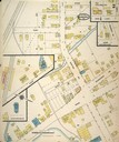
| Date: | 10 1914 |
|---|---|
| Description: | Page 2 of a Sanborn-Perris map of Pewaukee. |
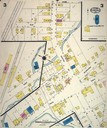
| Date: | 07 1924 |
|---|---|
| Description: | Page 3 of Sanborn-Perris map of Pewaukee. |

| Date: | 1918 |
|---|---|
| Description: | Page from the Standard Atlas of Grant County, Wisconsin of Part of Townships 5 and 6 North, Range 5 West of the 4th P.M. |

| Date: | 1911 |
|---|---|
| Description: | Plat Map of Blooming Grove in "Atlas of Dane County, Wisconsin." |

| Date: | 05 1926 |
|---|---|
| Description: | Section 1 of a Sanborn map of Osceola. |

| Date: | 05 1926 |
|---|---|
| Description: | Section 2 of a Sanborn map of Osceola. |
| Date: | 05 1926 |
|---|---|
| Description: | Section 3 of a Sanborn map of Osceola. |

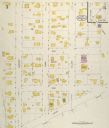
| Date: | 10 1911 |
|---|---|
| Description: | Section 1 of a Sanborn map of Osceola. |
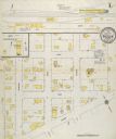
| Date: | 10 1911 |
|---|---|
| Description: | Section 2 of a Sanborn Map of Osceola. |

| Date: | 1905 |
|---|---|
| Description: | Map of state of Idaho. Department of Interior General Land Office. |

| Date: | 1941 |
|---|---|
| Description: | Official highway map of Wisconsin, "the playground of the Midwest," showing the state transportation network prior to World War II. |

| Date: | 1923 |
|---|---|
| Description: | Vilas County. Published by Chicago, Milwaukee, and St. Paul Ry. |
If you didn't find the material you searched for, our Library Reference Staff can help.
Call our reference desk at 608-264-6535 or email us at:

