Filter: Categories of Wisconsin Historical Images
Filter: Subject of Land
Filter: Year of 1800-1899
Filter: Categories of Wisconsin Historical Images
Filter: Subject of Land
Filter: Year of 1800-1899
| Date: | 1899 |
|---|---|
| Description: | The Clyde after being converted to a sternwheel rafter, pushing a tow with a locomotive on board. |

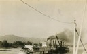
| Date: | 1890 |
|---|---|
| Description: | Bird's-eye map of Ashland, viewed from Lake Superior, with insets of Prentice Park and Fishery. Population 16,000. Increase in Ten Years, 11,000. |

| Date: | 1868 |
|---|---|
| Description: | The sidewheel packet, Keokuk, loaded with passengers beside a barge at a landing. The landing is filled with people and horse-drawn vehicles. The si... |
| Date: | 09 19 1892 |
|---|---|
| Description: | Captain Alexander McDougall's whaleback passenger steamer "Christopher Columbus" under construction in the shipyard of the American Steel Barge Company in ... |

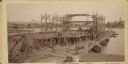
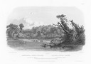
| Date: | 1872 |
|---|---|
| Description: | The sidewheel packet, Red Wing, in the Mississippi River near Queen's Bluff below Trempealeau, Wisconsin. |

| Date: | 1831 |
|---|---|
| Description: | Drawing of Fort Winnebago (near present-day Portage) that illustrated "Wau-Bun," Juliette Kinzie's memoir of her experiences on the early Wisconsin fronti... |

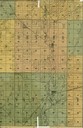
| Date: | 1861 |
|---|---|
| Description: | Drawn the first year of the Civil War, this colored 1861 map of Dane County shows its towns, cities and lakes. It includes insets of the wards of Madison a... |
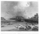
| Date: | 1832 |
|---|---|
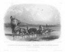
| Description: | Steamboat navigating through sunken trees on the Missouri River. |
| Date: | 1832 |
|---|---|
| Description: | Engraving of Indians on horseback along river with Indian grave on hill in background. |

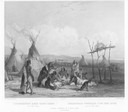
| Date: | 1832 |
|---|---|
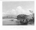
| Description: | Black and white engraving showing landscape with Fort Pierre and Indian tipis along the Missouri River. |
| Date: | 1832 |
|---|---|
| Description: | Funeral of a Sioux Chief near Fort Pierre. |
| Date: | 1832 |
|---|---|
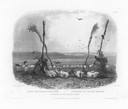
| Description: | Punka Indians encamped on the banks of the Missouri River and canoeing in river. |
| Date: | 1832 |
|---|---|
| Description: | Mih-Tutta-Hangkusch, a Mandan village with boats on the river in foreground. |
| Date: | 1832 |
|---|---|
| Description: | Offering of the Mandan Indians, showing human and animal skulls. |
| Date: | 1832 |
|---|---|
| Description: | Two dog-sledges hauling supplies, with one also carrying a Mandan. |

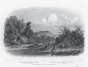
| Date: | 1832 |
|---|---|
| Description: | Junction of the Yellowstone River and the Missouri River. |
| Date: | 1890 |
|---|---|
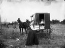
| Description: | A woman, possibly the daughter of C.R. Monroe, holding up an image of Black River Falls Main Street at the back of a traveling photographer's wagon. |
If you didn't find the material you searched for, our Library Reference Staff can help.
Call our reference desk at 608-264-6535 or email us at: