 Filter: Categories of Wisconsin Historical Images
Filter: Subject of Land
Filter: County of Milwaukee
Filter: Type of Map or Atlas
Filter: Categories of Wisconsin Historical Images
Filter: Subject of Land
Filter: County of Milwaukee
Filter: Type of Map or Atlas

| Date: | 1856 |
|---|---|
| Description: | View looking west from Lake Michigan with several steam ships and sailing vessels in harbor. There is a lighthouse to left of center, along shoreline. |

| Date: | 1882 |
|---|---|
| Description: | Bird's-eye views of various sections of Milwaukee. |

| Date: | 1898 |
|---|---|
| Description: | Bird's-eye map, looking west from shoreline on Lake Michigan of Milwaukee to Golden Lake in Waukesha County, with Kenosha and Fox Point at bottom corners, ... |

| Date: | 1876 |
|---|---|
| Description: | Made from U.S. Surveys and from minutes furnished by Jos. S. Buck and Dr. C. Chase. Scale 20 CHs to an inch. |

| Date: | 1882 |
|---|---|
| Description: | This basic reference map of the state shows natural features, railroads, county seats, and political boundaries against the G.L.O. township and range grid.... |

| Date: | 1908 |
|---|---|
| Description: | Colored map in perspective indicates railroad routes. Lake Winnebago and Oshkosh in center, area extends to Shawano (top right corner), Green Bay (bottom r... |

| Date: | 1853 |
|---|---|
| Description: | Plan no. 3. Scale 2000 feet to one inch. |

| Date: | 1894 |
|---|---|
| Description: | Sanborn map of a portion of Milwaukee, including St. Clair and Bishop and Potter Avenues. There is an inset for the South Side Wood Working Co. |

| Date: | 1894 |
|---|---|
| Description: | Sanborn Map of the Illinois Steel Co. Bay View Works in Milwaukee. |

| Date: | 1836 |
|---|---|
| Description: | This hand-colored manuscript map shows the township and section grid in southeastern Wisconsin, covering the area west to Sugar River and Four Lakes region... |

| Date: | 05 1846 |
|---|---|
| Description: | Hand-colored map of southeastern Wisconsin showing the counties of Dodge, Jefferson, Rock, Walworth, Racine (including modern-day Kenosha County), Waukesha... |

| Date: | 1972 |
|---|---|
| Description: | These maps show the Milwaukee County supervisory districts as of April 1972 and the Supervisor and Assembly districts in effect prior to the April 1972 ele... |

| Date: | 1966 |
|---|---|
| Description: | This map from the 1960s provides a detailed street map of Milwaukee County and eastern Waukesha County as far west as Menomonee Falls and Muskego Lake. A p... |

| Date: | 1830 |
|---|---|
| Description: | A hand-drawn map of the township sectioning of Milwaukee, eastern Waukesha, northern Walworth, and Racine Counties. Other items shown in the map are the la... |

| Date: | 1844 |
|---|---|
| Description: | An ink on paper, hand-drawn map of Milwaukee County that shows the sectioning of townships, the boundary of the canal grant, roads, streams, lakes, includi... |

| Date: | 1858 |
|---|---|
| Description: | An ink on paper map of Milwaukee County and the eastern portion of Waukesha County that shows the townships of Oak Creek, Franklin, Greenfield, Wauwatosa, ... |
| Date: | 1875 |
|---|---|
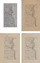
| Description: | A series of four, ink on tracing cloth maps of Milwaukee County, Wisconsin that show the topography, the Milwaukee and Menomonee rivers, and railroad of th... |

| Date: | 1976 |
|---|---|
| Description: | An 1876 reprinted map of the Township of Franklin, Milwaukee County, Wisconsin, that shows the land ownership and sectioning of the town, as well as the ro... |

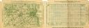
| Date: | 1896 |
|---|---|
| Description: | A map of Milwaukee County, Wisconsin that shows the township and range system, sections, towns, roads, railroads and rail stations, cities and villages, po... |
| Date: | 1918 |
|---|---|
| Description: | A road map of Milwaukee and Waukesha counties, that shows the status of roads as being good, completed, new work, proposed, state truck and those receiving... |
If you didn't find the material you searched for, our Library Reference Staff can help.
Call our reference desk at 608-264-6535 or email us at: