Filter: Categories of Wisconsin Historical Images
Filter: Subject of Land
Filter: County of Dane
Filter: Type of Map or Atlas
Filter: Categories of Wisconsin Historical Images
Filter: Subject of Land
Filter: County of Dane
Filter: Type of Map or Atlas
| Date: | 1940 |
|---|---|
| Description: | This map, oriented with north to the right, shows troop disposition and movements, including encampments, unit locations, lines of march, and lines of enem... |

| Date: | 1890 |
|---|---|
| Description: | Plat map of Madison, T7N R9E, including portions of the towns of Blooming Grove and Burke. Includes inset maps of South Madison, Quarrytown, Marril Park, a... |

| Date: | 1931 |
|---|---|
| Description: | A plat map of Springfield, Wisconsin. |

| Date: | 1908 |
|---|---|
| Description: | A Sanborn map of the isthmus, which includes the map key. |

| Date: | 1899 |
|---|---|
| Description: | A plat map of Pleasant Springs in Dane County. |

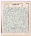
| Date: | 1899 |
|---|---|
| Description: | A plat map of the township of Christiana. |
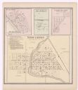
| Date: | 1873 |
|---|---|
| Description: | A page showing four plat maps: Stoughton, Clifton, Deanville, and Cross Plains. |
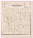
| Date: | 1873 |
|---|---|
| Description: | A plat map of the town of Pleasant Springs. |
If you didn't find the material you searched for, our Library Reference Staff can help.
Call our reference desk at 608-264-6535 or email us at: