 Filter: Categories of Wisconsin Historical Images
Filter: Subject of Lakes
Filter: Year of 1800-1899
Filter: Year of 1850-1859
Filter: Categories of Wisconsin Historical Images
Filter: Subject of Lakes
Filter: Year of 1800-1899
Filter: Year of 1850-1859

| Date: | 1853 |
|---|---|
| Description: | Map of a cross-section of southern Wisconsin, highlighting the La Crosse Milwaukee Rail Road. Shows canals, railroads, plank and post roads, and township g... |

| Date: | 1853 |
|---|---|
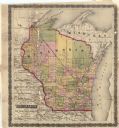
| Description: | This facsimile map shows counties, towns, and waterways in the state of Wisconsin. Included are portions of Iowa, Michigan, and Minnesota. Lake Superior an... |

| Date: | 1854 |
|---|---|
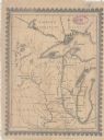
| Description: | This map shows the Manitowoc & Mississippi Railroad line along with other railroad lines in the Great Lakes Region. Lakes Superior, Michigan, Huron, Erie a... |

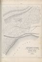
| Date: | 1858 |
|---|---|
| Description: | This map shows the proposed railways of the Tomah & Lake St. Croix Railroad (from Tomah to Hudson) and the St. Croix & Lake Superior Railroad (from Hudson ... |
| Date: | 1858 |
|---|---|
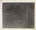
| Description: | This map shows drainage, acreages, and timber in the area now part of the Town of Shanagolden. The map includes a survey table, a meanders table, and certi... |

| Date: | 1856 |
|---|---|
| Description: | This map shows the railroad routes and connection of the Mineral Point Railroad. Lake Michigan is on the far right, while Lake Superior is at the top of th... |

| Date: | 1850 |
|---|---|
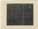
| Description: | This series of maps shows townships, ranges, sections, lakes, rivers, and roads. The maps cover areas between Township No. 26 and Township No. 42. |

| Date: | 1856 |
|---|---|
| Description: | This map shows the railroad routes that lead to Milwaukee. Included are portions of Minnesota, Iowa and Illinois. Lake Michigan is on the right, while Lake... |
| Date: | 1856 |
|---|---|
| Description: | This map shows township grids, existing settlements, Indian reservations, rivers, lakes, and treaty lines. Included is a portion of Minnesota. Lake Michiga... |

| Date: | 1857 |
|---|---|
| Description: | This map shows the railroad routes of the Milwaukee & Horicon Railroad, common roads, counties, canals, townships, cities, county towns, villages, post off... |

| Date: | 1857 |
|---|---|
| Description: | This map shows county boundaries, larger cities, lakes, rivers, and the railroad network. The main line is in red, and the Milwaukee and Chicago Railroad i... |
| Date: | 1857 |
|---|---|
| Description: | This map shows drainage, state boundaries, county boundaries, rivers, lakes, township lines, cities, and towns. The Milwaukee & Horicon Road road is indica... |
| Date: | 1855 |
|---|---|
| Description: | This map shows railroad lines from Chicago, with emphasis on the proposed railroad from Chicago to Madison to Lake Superior near the Ontonagon River. Inclu... |

| Date: | 1855 |
|---|---|
| Description: | This map shows the Fox River, Lake Winnebago, streets, and plats. Below the title reads: "N. F.&Co. will make surveys of lands and plat the same in the bes... |
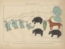
| Date: | 1851 |
|---|---|
| Description: | Pictograph E., Plate 63, "Kaizheosh, and his Band from Lake Vieu Desert. Michigan and Wisconsin." A group of symbols including birds, animals, a fish and a... |
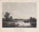
| Date: | 1858 |
|---|---|
| Description: | Engraved print of four men and a dog in a boat on Lake Winnebago. Two of the men are in the center of the boat holding hunting rifles, while one man is sta... |
| Date: | 1850 |
|---|---|
| Description: | A drawing of ancient works at the southeast angle of the Third Lake. |

| Date: | 1854 |
|---|---|
| Description: | A sketch of the public surveys of Wisconsin and territory of Minnesota. |

| Date: | 1857 |
|---|---|
| Description: | Green Lake County Abstract plat map, T. 14 N, R. 11 E. |

| Date: | 1857 |
|---|---|
| Description: | Green Lake County plat map, T. 15 N., R. 12 E. |
If you didn't find the material you searched for, our Library Reference Staff can help.
Call our reference desk at 608-264-6535 or email us at: