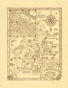
| Date: | 1855 |
|---|---|
| Description: | Map of Madison and surrounding communities, referred to as the four lakes country. Text bordering the map includes an excerpt of a letter written by Horace... |

| Date: | 1892 |
|---|---|
| Description: | This map oriented with north to the upper left shows railroads, creeks, post offices, smaller lakes, Lake Mendota, Lake Monona, Lake Wingra, Lake Waubesa, ... |

| Date: | 1915 |
|---|---|
| Description: | This 1915 map covers portions of Barron, Chippewa, and Rusk counties in Wisconsin. Shown are the township and range grid, sections, cities and villages, ra... |

| Date: | 1947 |
|---|---|
| Description: | Shows lot and block numbers, 28 points of interest in the upper left that correspond to numbers on the map, and landownership with acreages. "Erickson Brot... |

| Date: | 1940 |
|---|---|
| Description: | This map of Beaver Dam pictorially shows the history of the town. The map was made for the 100th anniversary celebration of Beaver Dam in 1941. The map inc... |
If you didn't find the material you searched for, our Library Reference Staff can help.
Call our reference desk at 608-264-6535 or email us at: