 Filter: Categories of Wisconsin Historical Images
Filter: Subject of Islands
Filter: Subject of transportation
Filter: Categories of Wisconsin Historical Images
Filter: Subject of Islands
Filter: Subject of transportation

| Date: | 1910 |
|---|---|
| Description: | View of tourists arriving on steamship. Many passengers are on the ship and the dock. |

| Date: | 1878 |
|---|---|
| Description: | A color map detailing Ashland and Bayfield counties, including Lake Superior and the Apostle Islands. |

| Date: | 07 01 1954 |
|---|---|
| Description: | Sigurd Olson, followed by Tony Lovink, at the beginning of their "grand portage." A large lake and islands are in the background. |

| Date: | 1913 |
|---|---|
| Description: | A wall atlas of Sauk County, Wisconsin, displaying its 22 towns. On the left side are advertisements for local businesses. |

| Date: | 1884 |
|---|---|
| Description: | Cover art for a pamphlet advertising The Apostle Islands and Lake Superior. The upper half of the artwork depicts a sunset view of Lake Superior, and the b... |
| Date: | |
|---|---|
| Description: | Tents line a beach along the Atlantic Ocean. Foliage covers the foreground and several people and vehicles can be seen throughout the camp. |

| Date: | |
|---|---|
| Description: | Bird's eye view of Coney Island featuring the amusement park, shoreline, river, and a large boat. |

| Date: | 1865 |
|---|---|
| Description: | Exterior of Fort Sumpter [sic]. There are several men and a boat on the shoreline in the foreground. Plate 56 |

| Date: | |
|---|---|
| Description: | Individuals use rowboats near the shore of Marlin's Island on the Wisconsin River. |

| Date: | |
|---|---|
| Description: | View of Tivoli Island, situated in the Rock River. A bridge spans from the island to the river bank on the right. Caption reads: "Tivoli Island." |
| Date: | 1949 |
|---|---|
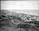
| Description: | Elevated view of three rowboats floating in the water off a rocky shore, and in the distance several rocky islands with trees. |
| Date: | |
|---|---|
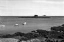
| Description: | View of Kettle Island as seen from Coolidge Point. A residence stands among trees on Coolidge Point. |

| Date: | |
|---|---|
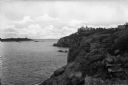
| Description: | Elevated view of Wickets Island, a small island in a bay with dense foliage. A large tower is on the island and boats are in the bay. |

| Date: | |
|---|---|
| Description: | Bird's-eye view lithograph of Key West with ships and smaller boats in the surrounding waters. |
| Date: | |
|---|---|
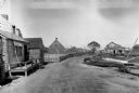
| Description: | General view of town streets, with a harbor and early American store exteriors. |

| Date: | |
|---|---|
| Description: | Elevated city view showing the sea and islands. A bridge spans the shoreline. Published by Owl Drug Co. |

| Date: | |
|---|---|
| Description: | Elevated view showing the city, bridges, and boats. |

| Date: | 1959 |
|---|---|
| Description: | Aerial view of the island of Cuba taken from a small plane. Part of the plane with a Cuban flag painted on it is in the frame, and the island with many bui... |

| Date: | |
|---|---|
| Description: | The top elevated view shows the Wisconsin River with several boats. The bottom view includes the river and the Northwestern Railroad bridge from the shorel... |
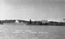
| Date: | 1937 |
|---|---|
| Description: | View from the lake of the summer homes on Nebraska Row along the shoreline of Lake Superior. The water tower and church steeple are visible on the far righ... |
If you didn't find the material you searched for, our Library Reference Staff can help.
Call our reference desk at 608-264-6535 or email us at: