Filter: Categories of Wisconsin Historical Images
Filter: Subject of Islands
Filter: Type of Map or Atlas
Filter: Subject of water
Filter: Categories of Wisconsin Historical Images
Filter: Subject of Islands
Filter: Type of Map or Atlas
Filter: Subject of water

| Date: | 1881 |
|---|---|
| Description: | Ink, watercolor, and pencil on paper. Top of the map reads: "NORTHERN OUTLET MENASHA MEANDER LINES Scale 132ft 1 INCH Var S.E. Survey Completed Spet. 23 18... |

| Date: | 08 24 1899 |
|---|---|
| Description: | Pen-and-ink and color on paper. Also shows probable routes of the French explorers Constant le Marchand de Lignery in 1728 and Louis de la Porte de Louvign... |

| Date: | 1890 |
|---|---|
| Description: | Shows plat of town, local streets, steam boat landings, and Chippewa River. Public square and Muskoo Island hand-colored. Map reads: "Full Lots are 125x66 ... |

| Date: | 1918 |
|---|---|
| Description: | Map showing Aleppo, Zor, Syria, Lebanon, Beirut, Jerusalem, with an inset map of the Sinai Peninsula and Egyptian frontier. Also shows the locations of rai... |

| Date: | 1831 |
|---|---|
| Description: | Map of the city of Louisville, Kentucky on the Ohio River showing streets and numbered lots. The Ohio River, Corn Island, and the Louisville and Portland C... |

| Date: | 1828 |
|---|---|
| Description: | Map of the Louisville and Portland Canal on the Ohio River. The map shows Louisville, Shippingsport, Clarksville, Jeffersonville, Gravel Island, Corn Islan... |

| Date: | 1899 |
|---|---|
| Description: | A plat map of the township of Westport. |

| Date: | 2013 |
|---|---|
| Description: | Map is the most extensive endeavor to date to accurately locate and document both prehistoric place names and natural features of the Menominee language wi... |

| Date: | 1876 |
|---|---|
| Description: | This map is of the towns of Neenah and Menasha and shows existing and proposed canals. Water depths shown by soundings. Little Butte des Morts Lake, Doty I... |

| Date: | 1880 |
|---|---|
| Description: | This map of La Crosse shows the Chicago, Milwaukee and St. Paul Railroad, the Southern Minnesota Railroad and the Chicago, Dubuque and Minnesota Railroad, ... |

| Date: | 1891 |
|---|---|
| Description: | This map of La Crosse shows eighteen city wards in red, railroads, cemeteries, fair grounds, labeled streets, islands, and the Mississippi River. The left ... |

| Date: | 1893 |
|---|---|
| Description: | This map of La Crosse shows wards 1-20, streets, railroads, the Inter State Fair Grounds, islands, and the Mississippi River. Relief is shown by hachures. ... |

| Date: | 1940 |
|---|---|
| Description: | This map of La Crosse shows different types of land zoning: residence, multiple dwelling, local business, commercial, light industrial, heavy industrial, w... |

| Date: | 1950 |
|---|---|
| Description: | This map is intended for tourists visiting La Crosse. The front of the map provides extensive text on attractions and activities in La Crosse while the bac... |

| Date: | 1720 |
|---|---|
| Description: | Double hemispherical world map showing routes of Tasman, Magellan, Mendana, etc. Relief shown pictorially. Title in oak wreath cartouche. Map between four ... |

| Date: | 1740 |
|---|---|
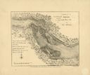
| Description: | From Weigel's Atlas portatilis, oder, Compendieuse Vorstellung der gantzen Welt. Map of Europe. |

| Date: | 1800 |
|---|---|
| Description: | This map of the Little Kaukalin Region is ink on paper and shows Little Kaukalin Rapids, Black Bird Island, buildings, trails, meadows and woods, and a sug... |

| Date: | 1712 |
|---|---|
| Description: | Engraved double-hemispherical world map by Moll, included in his atlas The world described, or, A new and correct sett of maps: shewing the kingdoms and st... |

| Date: | 1696 |
|---|---|
| Description: | Engraved and hand-colored map of Ethiopia, from Blaeu's General Atlas. Map title is framed by a man and a woman, both wearing head turbans, who are standin... |
If you didn't find the material you searched for, our Library Reference Staff can help.
Call our reference desk at 608-264-6535 or email us at: