| Date: | 02 03 1948 |
|---|---|
| Description: | Fourth graders in Mrs. Jerry Frei's class at Marquette school celebrate Mexican studies by writing a play, "Mexican Fiesta," and adopting Spanish names and... |

| Date: | 02 13 1950 |
|---|---|
| Description: | The University of Wisconsin Dames Club has a number of war brides from foreign countries who have gravitated to the international relations group. Mrs. Ke... |

| Date: | |
|---|---|
| Description: | Formal portrait of Marion Bloch with baby Sally Ann. |

| Date: | 1943 |
|---|---|
| Description: | President Franklin Roosevelt and Mrs. Roosevelt on the officials platform during a visit to Monterrey, Mexico. Standing between them (and also pictured on ... |

| Date: | 1916 |
|---|---|
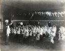
| Description: | A group of children sitting at desks raising their arms while being led in a classroom activity by a male instructor. Four women and one man are sitting an... |

| Date: | |
|---|---|
| Description: | Ben Bergor, Madison magician, ventriloquist, and entertainment agent, performing with Jerry O'Reilly at a farm show. With Bergor is his wife Alva who often... |

| Date: | 02 11 1961 |
|---|---|
| Description: | Ninety-two foreign students attending the U.W., Beloit, and Milton Colleges representing 35 countries took buses to Janesville where they were guests of th... |

| Date: | 1746 |
|---|---|
| Description: | Map of North America from the southern portion of James Bay to Florida. It shows the colonies, cities, Native American land, and topological and geographic... |

| Date: | 1710 |
|---|---|
| Description: | Map of North America showing the European claims, Native American land and villages, rivers, lakes, cities, and notes on explorers, discoveries, and topogr... |

| Date: | 1719 |
|---|---|
| Description: | Map of North America showing land divisions between France, Spain, England, Sweden, Denmark and Holland. The map is detailed, labeling cities, forts, islan... |
If you didn't find the material you searched for, our Library Reference Staff can help.
Call our reference desk at 608-264-6535 or email us at: