Filter: Categories of Wisconsin Historical Images
Filter: Subject of Indian reservations
Filter: Subject of transportation
Filter: Categories of Wisconsin Historical Images
Filter: Subject of Indian reservations
Filter: Subject of transportation

| Date: | 1936 |
|---|---|
| Description: | This map is red and black ink on tracing cloth and is oriented with north to the upper left. This hand-drawn map shows a central portion of the military ro... |

| Date: | 1886 |
|---|---|
| Description: | This map shows U.S. land offices, completed railroads, railroad land grant limits, lakes, rivers, and Indian reservations. Communities, lakes, and rivers a... |
| Date: | |
|---|---|
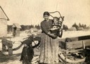
| Description: | A Chippewa (Ojibwa) mother with two children, one of whom is in a cradleboard, at the Lac du Flambeau reservation. This image is part of an exhibit about N... |

| Date: | 1953 |
|---|---|
| Description: | Color photograph of young Native-American men dressed in traditional clothing standing around an International R-Line truck. The young men are with a small... |
| Date: | |
|---|---|
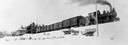
| Description: | View from bottom of snowy hill looking up towards the Wisconsin & Northern Railroad engine #3, which was purchased from the Grand Rapids & Indiana Railway. |
| Date: | |
|---|---|
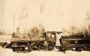
| Description: | Three men stand in the snow in front of the Wisconsin & Northern Railroad engine #2 (the second locomotive with this number) in the woods on the Menominee ... |
| Date: | 1897 |
|---|---|
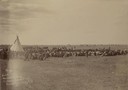
| Description: | Slightly elevated view across field of a Sioux women's Episcopal Convocation meeting at the Rosebud Agency. The women, and a number of children, are sittin... |
| Date: | 1950 |
|---|---|
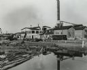
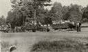
| Description: | A sawmill run on the Menominee Indian Reservation. |
| Date: | |
|---|---|
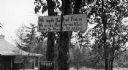
| Description: | A toll road sign on the Keshena Menominee Reservation for the Highway 55 toll road that goes through the reservation. |
| Date: | 1936 |
|---|---|
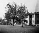
| Description: | St. Joseph's Indian School on the Keshena Menominee Reservation. |

| Date: | 1939 |
|---|---|
| Description: | A color, pictorial map. Scale: 10 miles to the inch. Shows state parks and forests, proposed state parkways, proposed state monuments and memorials, nation... |
| Date: | 1933 |
|---|---|
| Description: | Native Americans hired to assist with the White Pine Blister Rust eradication effort on the Menominee Reservation are being trucked to their work site. |

| Date: | 1936 |
|---|---|
| Description: | Loading a large white pine log cut on the Menominee Indian Reservation onto a truck. The log was hauled to the Wisconsin State Fair for a display about the... |
| Date: | 1935 |
|---|---|
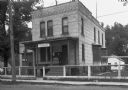
| Description: | U.S. Department of the Indian agency building on the Menominee Indian Reservation. |
| Date: | 1900 |
|---|---|
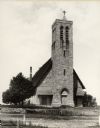
| Description: | Hobart Episcopal Church on the Oneida Indian Reservation. |
| Date: | 1913 |
|---|---|
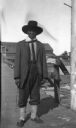
| Description: | Portrait of Chippewa (Ojibwa) man at Bad River Indian Reservation. |

| Date: | 1886 |
|---|---|
| Description: | Wisconsin map showing land offices, railroads completed, railroad land grants and Indian reservations. |

| Date: | 1896 |
|---|---|
| Description: | This hand-colored map shows counties, county seats, cities, towns, proposed and completed railroads, and U.S. Land Offices. Also included in the map are th... |

| Date: | 1900 |
|---|---|
| Description: | A map of Wisconsin, eastern Minnesota and Iowa, northern Iowa, and Michigan’s Upper Peninsula, showing railway lines, with those marked with heavy red line... |
If you didn't find the material you searched for, our Library Reference Staff can help.
Call our reference desk at 608-264-6535 or email us at: