 Filter: Categories of Wisconsin Historical Images
Filter: Subject of Hunting
Filter: Year of 1900-1999
Filter: Year of 1980-1989
Filter: Categories of Wisconsin Historical Images
Filter: Subject of Hunting
Filter: Year of 1900-1999
Filter: Year of 1980-1989
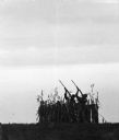
| Date: | 11 1981 |
|---|---|
| Description: | "These hunters are in a field near Soo Road and Hwy 175." |

| Date: | 1986 |
|---|---|
| Description: | This late 1980s map of Price County, Wisconsin, shows facilities and lands open for public recreation, hunter walking trails and ski trails, campgrounds, b... |

| Date: | 10 1981 |
|---|---|
| Description: | Members of the Rod and Gun Club released birds on grounds they use for hunting on the day preceding the opening of pheasant hunting season. Pictured is Chu... |

| Date: | 10 1981 |
|---|---|
| Description: | All pheasants raised by the Theresa Rod and Gun Club wear blinders. Pheasants raised in captivity tend to peck each other so blinders are used to prevent t... |

| Date: | 1983 |
|---|---|
| Description: | This map covers Vilas county as well as parts of Iron, Oneida, and Forest counties. Club trails are shown in dotted red lines and state trails are shown in... |

| Date: | 1987 |
|---|---|
| Description: | This map shows county forests, state, federal, and interstate highways. County forests lands are shown in light green. The front of the map includes images... |
If you didn't find the material you searched for, our Library Reference Staff can help.
Call our reference desk at 608-264-6535 or email us at: