| Date: | 1930 |
|---|---|
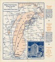
| Description: | Map of the routes of the screw passenger and freight vessels of the Michigan Transit Company. Includes a picture of the Park Place hotel in Traverse City, ... |

| Date: | 1930 |
|---|---|
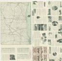
| Description: | Pictorial map of Glacier National Park, Montana and Waterton Lakes National Park, Alberta. Illustrated by Joe Scheurle, it depicts white people, American ... |

| Date: | 1930 |
|---|---|
| Description: | The back of the pictorial map titled Recreational Map of Glacier National Park, Montana: Waterton Lakes National Park, Alberta. 14 panels of text and photo... |

| Date: | 1909 |
|---|---|
| Description: | A brochure with a map showing the North-Western Railway lines from northern Illinois, starting at Chicago, to southeastern Wisconsin, stopping at Sheboygan... |

| Date: | 1920 |
|---|---|
| Description: | This early road map shows the system of roads in Wisconsin, northern Illinois, northeastern Iowa, southeastern Minnesota, and the western portion of Michig... |

| Date: | 1950 |
|---|---|
| Description: | This road map shows federal, state and county roads in Wisconsin, northern Illinois, northeastern Iowa, eastern Minnesota, and the western portion of Michi... |

| Date: | 1915 |
|---|---|
| Description: | This 1915 map covers portions of Barron, Chippewa, and Rusk counties in Wisconsin. Shown are the township and range grid, sections, cities and villages, ra... |

| Date: | 1926 |
|---|---|
| Description: | This 1926 map depicts resorts and camps, lakes and streams, railroads, and roads in portions of Vilas, Iron, Oneida, Price, and Lincoln counties in Wiscons... |

| Date: | 1930 |
|---|---|
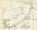
| Description: | Shows roads, fire stations, golf course, and accommodations around Delavan Lake. "The drive around the lake is divided into zones from 0 to 900 as shown. P... |

| Date: | 1940 |
|---|---|
| Description: | This tourist map of Door County, Wisconsin, lists the points of interest and tourist hotels, cabins and cottages in the area. Ferry schedules to Washington... |

| Date: | 1915 |
|---|---|
| Description: | This 1915 map covers the section of the Wisconsin River in southern Adams, southeastern Juneau, northeastern Sauk, and northwestern Columbia counties. A po... |

| Date: | 1909 |
|---|---|
| Description: | This 1909 map of northern Wisconsin and a portion of Michigan's Upper Peninsula shows the Lac du Flambeau Indian Reservation, cities and villages, railroad... |

| Date: | 1930 |
|---|---|
| Description: | "Issued by Door County Chamber of Commerce." Shows federal system highways, state highways, county trunk highways, country roads, and parks. Includes direc... |

| Date: | 1907 |
|---|---|
| Description: | Shows public buildings, hotels, fraternity houses, and private houses. Index of fraternities and sororities, residences, public buildings, hotels, places o... |

| Date: | 1927 |
|---|---|
| Description: | Map reads: "Now You Can Visualize Madison". Includes indexes, with points marked 1-98 and a key. Text and illustrations on verso include hotels and seasona... |

| Date: | 1938 |
|---|---|
| Description: | The map includes text, illustrations, a railroad fare table (season 1938), a Directory of resorts and hotels, and a regional map on the back. |

| Date: | 1959 |
|---|---|
| Description: | This map of Lake Geneva has relief shown by contours and water depths shown by isolines. The map includes an index of schools, churches, public services, i... |

| Date: | 1910 |
|---|---|
| Description: | This map is ink and pen on tracing cloth and shows plat of the town, local streets, county roads, railroads, school houses, town halls, hotels, sheds, barn... |

| Date: | 1919 |
|---|---|
| Description: | This map is a topographical map and has relief shown by contours. The map shows roads, state highways, hotels, town halls, school houses, stores, barns, de... |
If you didn't find the material you searched for, our Library Reference Staff can help.
Call our reference desk at 608-264-6535 or email us at: