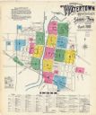
| Date: | 04 1901 |
|---|---|
| Description: | A Sanborn map of Watertown, including an index and a key. |

| Date: | 1877 |
|---|---|
| Description: | A page from an illustrated historical atlas showing four residences, a hotel and the flouring mill of John Ochsner. |

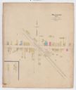
| Date: | 10 1894 |
|---|---|
| Description: | A Sanborn Fire Insurance Map of Waunakee. |

| Date: | 1975 |
|---|---|
| Description: | Colored bird's-eye map of the Lake Region of Waukesha County. Looking North from Government Hill. All these Lakes and Resorts are withing Four hours ride o... |

| Date: | 1892 |
|---|---|
| Description: | A Sanborn fire insurance map of Sauk City which was drawn up in 1892. |

| Date: | 1900 |
|---|---|
| Description: | A Sanborn fire insurance map of Sauk City created in 1900. |

| Date: | 1915 |
|---|---|
| Description: | A Sanborn fire insurance map of Sauk City created in 1915. |

| Date: | 1891 |
|---|---|
| Description: | Page 13 of a Sanborn map of Stevens Point. |
If you didn't find the material you searched for, our Library Reference Staff can help.
Call our reference desk at 608-264-6535 or email us at: