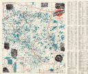
| Date: | 1939 |
|---|---|
| Description: | This brochure was intended for tourists and shows resorts, lakes and railroads in northwestern Wisconsin and part of Michigan’s upper peninsula. Also inclu... |

| Date: | 1942 |
|---|---|
| Description: | This map shows the route of the Milwaukee Road, roads, foot trails, resorts, and ranger stations. The map includes text, illustrations, a railroad fare tab... |

| Date: | 2006 |
|---|---|
| Description: | This map includes indexed advertisements and map of the Lac du Flambeau region on back. The map is broken into 9 zones, each marked with state and club tra... |

| Date: | 1980 |
|---|---|
| Description: | This map shows schools, hotels, stations, roads, railroads, reefs, and public buildings. The upper right corner includes "A Summer and Winter Guide for Spo... |
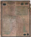
| Date: | 1857 |
|---|---|
| Description: | This map shows lot and block numbers, buildings, some land ownership, wards, waterways, streets, railroads, brick yards, and cemeteries. It includes an ind... |

| Date: | 1960 |
|---|---|
| Description: | This pictorial map shows recreation activities, rivers, lakes, and the history of the area. The map covers Langlade County and parts of adjacent counties. ... |

| Date: | 1953 |
|---|---|
| Description: | This map shows locations of State Medical Society, nine medical facilities, two University of Wisconsin buildings, four transportation centers, and five ho... |

| Date: | 1864 |
|---|---|
| Description: | This map is pen and watercolor on paper and shows a profile and the geological formation of Blue Mound. Also shown is the location of Arnold's Hotel and Br... |

| Date: | 1935 |
|---|---|
| Description: | This blue lined map shows the major roads and cities of Wisconsin. The map includes an index, hotel and cafe advertisements, as well as advertisements for ... |

| Date: | 1935 |
|---|---|
| Description: | This blue lined map ("compliments of Black Eagle Oil Company") shows the major roads and cities of Wisconsin. The map includes an index, hotel and cafe adv... |

| Date: | 1937 |
|---|---|
| Description: | This map shows the major cities, towns, highways, roads, lakes, and rivers of Wisconsin and some of the neighboring states. An index is included on the fro... |
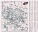
| Date: | 1941 |
|---|---|
| Description: | This map highlights the fishing district and shows labeled rivers, lakes, cities, county boundaries and points of interest. The map includes a list of trai... |
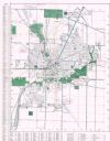
| Date: | 10 1969 |
|---|---|
| Description: | A street map of Janesville showing the block numbers on each street. Other landmarks are labeled such as chain stores, parks, schools, manufacturing compa... |
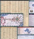
| Date: | 2004 |
|---|---|
| Description: | This map shows ATMs, houses of worship, hotels, parking ramps, public parking, union cab stands, bus stops, business district, parks and public areas, gove... |
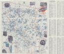
| Date: | 1922 |
|---|---|
| Description: | This map shows in red the NorthWestern Railway Line routes running from Chicago, Illinois to northern Wisconsin. The map includes cities and towns, lakes, ... |
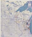
| Date: | 1929 |
|---|---|
| Description: | This map shows the entire state of Wisconsin and Minnesota and portions of Illinois and Iowa. Counties, cities, highways, lakes, and rivers are labeled. Ro... |

| Date: | 1928 |
|---|---|
| Description: | This map shows the entire state of Wisconsin as well as portions of Michigan, Minnesota, Iowa and Illinois. Lake Michigan, Lake Superior, Lake Winnebago a... |
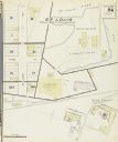
| Date: | 1892 |
|---|---|
| Description: | A Sanborn map of St. Louis, which is six miles southwest of South Superior. |

| Date: | 1935 |
|---|---|
| Description: | This road map shows automobile routes across the state of Wisconsin. Advertisements for various hotels are featured along the bottom edge of the map, while... |
If you didn't find the material you searched for, our Library Reference Staff can help.
Call our reference desk at 608-264-6535 or email us at: