 Filter: Categories of Wisconsin Historical Images
Filter: Subject of Historic sites
Filter: Subject of architecture
Filter: Type of Map or Atlas
Filter: Categories of Wisconsin Historical Images
Filter: Subject of Historic sites
Filter: Subject of architecture
Filter: Type of Map or Atlas

| Date: | 1960 |
|---|---|
| Description: | This mid-20th century tourist brochure for Bayfield County, Wisconsin, includes a map of the county showing towns, cities and villages, highways and roads,... |

| Date: | 1967 |
|---|---|
| Description: | This map of Cedarburg includes a list of historic buildings in the left margin. The map was created by the Ozaukee County Historical Society for Cedarburg'... |
| Date: | 1974 |
|---|---|
| Description: | This map of Milwaukee shows forty landmark buildings located and identified, including those on the National Register of Historic Places and the Historic A... |
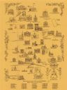
| Date: | 1970 |
|---|---|
| Description: | This pictorial map shows illustrations of historical landmarks and events, some of which include the fairgrounds, churches, the courthouse, Turner Opera Ho... |

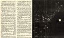
| Date: | 1970 |
|---|---|
| Description: | This photocopy map shows the locations of historic buildings, as well as all other buildings in the isthmus. The map also includes photographs of selected ... |
If you didn't find the material you searched for, our Library Reference Staff can help.
Call our reference desk at 608-264-6535 or email us at:
