| Date: | 12 21 1882 |
|---|---|
| Description: | Bird's-eye map of Kaukauna, from the Appleton Post Annual Review. |

| Date: | 1878 |
|---|---|
| Description: | Bird's-eye map of Kewaskum. Includes a list of hotels, churches, post office, railroad depot, etc. |

| Date: | 1879 |
|---|---|
| Description: | Bird's-eye map of Lake Mills. |

| Date: | 1883 |
|---|---|
| Description: | Bird's-eye map of Prairie du Sac, Wisconsin with an inset of Clifton. |

| Date: | 1875 |
|---|---|
| Description: | Bird's-eye map of Richland Center. |

| Date: | 1879 |
|---|---|
| Description: | Bird's-eye map of Two Rivers. |

| Date: | 1879 |
|---|---|
| Description: | Bird's-eye view of Viroqua, county seat of Vernon County. |

| Date: | 1905 |
|---|---|
| Description: | Map of state of Idaho. Department of Interior General Land Office. |

| Date: | |
|---|---|
| Description: | A hand-drawn map including the location of Daniel Boone's home and two forts, northeast of Lexington, Kentucky. |

| Date: | 1844 |
|---|---|
| Description: | Part of a series of local maps, showing a number of burial mounds in the shape of animals near Madison, Wisconsin along military road. The maps also show d... |

| Date: | 1900 |
|---|---|
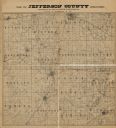
| Description: | A map of Jefferson County, Wisconsin, that identifies named hills, other points of interest, and the Lake Mills moraine system in the county and identifies... |

| Date: | 1947 |
|---|---|
| Description: | An ink on paper, hand-drawn map of Jefferson County, Wisconsin, that identifies named hills, other points of interest, and the Lake Mills moraine system in... |

| Date: | 1909 |
|---|---|
| Description: | This 1909 chart of the Apostle Islands, Chequamegon Bay, and the Lake Superior shoreline shows relief by contours and spot heights and depths by contours, ... |

| Date: | 1864 |
|---|---|
| Description: | This map is pen and watercolor on paper and shows profile and geological formation of Blue Mound and location of Arnold’s Hotel and Brigham Lead Mines. |

| Date: | 1902 |
|---|---|
| Description: | Map of Southern Norway with text in Norwegian. The scale of the map is 1:500000. |

| Date: | 1902 |
|---|---|
| Description: | Map of Southern Norway with text in Norwegian. Scale of map 1:500000. |

| Date: | 1973 |
|---|---|
| Description: | Map shows sections, trails, roads, and locations of ancient burial grounds, hills, groves, and settlers. Printed in brown ink. |
If you didn't find the material you searched for, our Library Reference Staff can help.
Call our reference desk at 608-264-6535 or email us at: