| Date: | 1910 |
|---|---|
| Description: | Bird's-eye view looking east, with Washburn Harbor at center and Chequamegon Bay in Lake Superior covering most of the upper image. Streets with buildings... |

| Date: | 1892 |
|---|---|
| Description: | Bird's-eye view of Chicago, with ships in the Lake Michigan harbor. |

| Date: | |
|---|---|
| Description: | Bird's-eye view lithograph of Key West with ships and smaller boats in the surrounding waters. |

| Date: | |
|---|---|
| Description: | Elevated general view of the city with harbor and mountains. A ship is docked near the railroad bridge. |

| Date: | 1848 |
|---|---|
| Description: | Pen-and-ink on paper. The title of the map is inscribed on the back. The map shows buildings, roads, marshes, wild rice, piles and docks, deep water, and o... |

| Date: | 1951 |
|---|---|
| Description: | This map of Racine Harbor has relief shown by contours and depths shown by gradient tints and soundings in feet. The map also shows Racine Reef, Wind Point... |

| Date: | 1961 |
|---|---|
| Description: | This map shows established harbor lines, local streets, railroads, U.S. government channel, and part of Fox River. The map includes a table of reference po... |

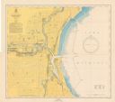
| Date: | 1951 |
|---|---|
| Description: | This map is a survey of Lake Michigan and the section of Milwaukee that borders the lake. Map of land includes major streets, and landmarks near water. Rel... |

| Date: | 1857 |
|---|---|
| Description: | This map was created from a survey made in December 1855 and shows local streets, proposed roads, railroads, the lake shore, bridge wharfs, the basin, the ... |

| Date: | 1900 |
|---|---|
| Description: | This map shows streets, railroads, dock and harbor lines, and parks. The map includes population tables for 1880, 1890, 1900. |

| Date: | 06 25 1901 |
|---|---|
| Description: | This map shows beacons, buoys, docks, quarries, streets, and buildings. The map inset shows the Harbor of refuge at entrance to Sturgeon Bay and Lake Michi... |

| Date: | 1867 |
|---|---|
| Description: | This map shows components of the bottom of Lake Michigan and the Root River, as well as the harbor, buildings, streets, railroads, and rural landowners in ... |

| Date: | 1948 |
|---|---|
| Description: | This map shows the land parcels, streets, and parks near the harbor. It includes a wind chart and 7 cross sections of borings/probings and docks. It also i... |

| Date: | 07 06 1931 |
|---|---|
| Description: | Text on front reads: "Where Green Bay and Sturgeon Bay Meet, Sturgeon Bay, Wis." Aerial view of Sturgeon Bay showing the only bridge in existence at the ti... |
If you didn't find the material you searched for, our Library Reference Staff can help.
Call our reference desk at 608-264-6535 or email us at: