 Filter: Categories of Wisconsin Historical Images
Filter: Subject of Harbors
Filter: Subject of forests and forestry
Filter: Categories of Wisconsin Historical Images
Filter: Subject of Harbors
Filter: Subject of forests and forestry

| Date: | |
|---|---|
| Description: | View from shoreline of boats docked at the fishing wharf. People are fishing from the pier, and a group of people are in a rowboat near a ferry. There are ... |
| Date: | 08 20 1964 |
|---|---|
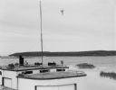
| Description: | View over fishing boat of Rock Island, as seen from Jackson Harbor. |

| Date: | |
|---|---|
| Description: | Elevated view of Fort Seward from Mount Rippinsky, showing Pyramid Harbor and Davidson Glacier in distance. Caption reads: "Haines and Fort Wm. H. Seward f... |

| Date: | 1972 |
|---|---|
| Description: | Aerial view of commercial buildings and dwellings along the shore of Lake Michigan. Caption reads: "Baileys Harbor, Wisc." |

| Date: | 1831 |
|---|---|
| Description: | This map shows the land that makes up Michigan, Wisconsin, Minnesota, Indiana, and parts of Canada. The Great Lakes are displayed prominently, along with s... |

| Date: | 1630 |
|---|---|
| Description: | One of the few maps by Dutch cartographer Willem Blaeu depicting the Americas, this map shows regions, settlements, islands, mountains, forests, rivers, an... |

| Date: | 1733 |
|---|---|
| Description: | This map of North America shows settlements, rivers, lakes, Native American land, trade winds, and numerous topographical features such as forests and moun... |
If you didn't find the material you searched for, our Library Reference Staff can help.
Call our reference desk at 608-264-6535 or email us at: