
| Date: | 1862 |
|---|---|
| Description: | Drawn the second year of the Civil War, this 1862 map of Milwaukee shows post offices, light houses, beacon lights, county buildings, elevator warehouses, ... |

| Date: | 1857 |
|---|---|
| Description: | This map of Sheboygan Harbor shows the river mouth and harbor, piers, wharfs, piles of old destroyed bridge wharfs, streets, and the lake shore from survey... |

| Date: | 05 1958 |
|---|---|
| Description: | Photocopy of a map created by the City of Milwaukee Master Plan Program City Planning Division in May of 1958 representing 1870 "THE CENTRAL AREA OF THE CI... |

| Date: | 1836 |
|---|---|
| Description: | This map is pen-and-ink on paper and shows marshlands, rivers, creeks, a quarry, and a few roads. |
| Date: | 1909 |
|---|---|
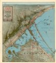
| Description: | This map of Duluth and Superior was issued by the Duluth Street Railway Company and shows street railway routes in the cities, as well as lakes, bays, harb... |
| Date: | 1964 |
|---|---|
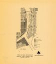
| Description: | This map of Two Rivers shows the Rodgers street fishing area and land use. The map features a legend on the right of the types of land use. The map also sh... |

| Date: | 1900 |
|---|---|
| Description: | This map shows streets, railroads, dock and harbor lines, and parks. The map includes population tables for 1880, 1890, 1900. |
| Date: | 09 1853 |
|---|---|
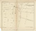
| Description: | This map shows streets, docks, warehouses, and piers near the harbor. The Manitowoc River and Lake Michigan are labeled. Depths are indicated by soundings ... |
| Date: | 1856 |
|---|---|
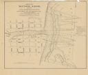
| Description: | This map shows streets, piers, and wharves. Lake Michigan, the Manitowoc River, and select buildings are labeled. Relief is shown by hachures and sounding... |
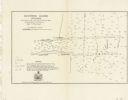
| Date: | 1865 |
|---|---|
| Description: | This map shows the river shore and piers. Lake Michigan is labeled. Depths are shown by soundings and isolines. The bottom margin includes notes on soundi... |
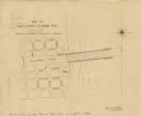
| Date: | 1874 |
|---|---|
| Description: | This map shows piers, streets, the Manitowoc River and shore lines of 1856, 1869, 1873 and 1874. The top margin reads; "Soundings taken 1974." Written in i... |

| Date: | 10 13 1864 |
|---|---|
| Description: | This map shows the shore line of Oct. 14 1864, city limits of water lots, and the elevation of water in Lake Michigan. Depths are shown by soundings. |

| Date: | 10 1853 |
|---|---|
| Description: | This map shows warehouses and proposed extensions of piers. "Note: The soundings are in feet and tenths." The upper left margin reads: "Senate Ex. Doc. No.... |

| Date: | 10 1853 |
|---|---|
| Description: | This map shows warehouses and proposed extensions of piers. Also included are notes on soundings and the proposed extensions. The upper right margin reads:... |

| Date: | 1865 |
|---|---|
| Description: | This map shows a proposed extension and the shore line of Sept. ’65. Lake Michigan is labeled. Depths are shown by soundings. |

| Date: | 1865 |
|---|---|
| Description: | This map shows the harbor with proposed extensions and the shore line as it appeared in 1865. Depths are shown by soundings. |

| Date: | 1857 |
|---|---|
| Description: | This map shows piers, wharves, streets, and the lake shore from the survey of August 1856. Lake Michigan and the Sheboygan River are labeled. Depths are sh... |

| Date: | 1905 |
|---|---|
| Description: | This map shows railroads, towns, lights, lights to be established, fog signals, light-vessels, lighted buoys, light-house depots, and light-house reservati... |

| Date: | 1970 |
|---|---|
| Description: | This map shows roads, parks, swimming beaches, golf courses, yacht harbors, light houses, airports, public hunting grounds, waysides, schools, and fishing ... |

| Date: | 1936 |
|---|---|
| Description: | This map shows campsites, trails, auto roads, surrounding townships, and points of interest, by including pictorial illustrations. Includes an inserted map... |
If you didn't find the material you searched for, our Library Reference Staff can help.
Call our reference desk at 608-264-6535 or email us at: