| Date: | 1898 |
|---|---|
| Description: | Bird's-eye map, looking west from shoreline on Lake Michigan of Milwaukee to Golden Lake in Waukesha County, with Kenosha and Fox Point at bottom corners, ... |

| Date: | 1830 |
|---|---|
| Description: | A color map of the Michigan and Wisconsin territories with an inset showing the Ste. Marie River. |

| Date: | 1862 |
|---|---|
| Description: | Lithography of C. Van Benthuysen. |

| Date: | 1839 |
|---|---|
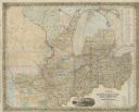
| Description: | Shows locations of cities, towns, villages, post hamlets, canals, rail and stage roads. Includes table of steamboat routes and distances; vignette of "Maid... |

| Date: | 1852 |
|---|---|
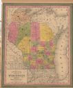
| Description: | Map shows Wisconsin counties by color and includes rivers, lakes and some cities. This information is also given for eastern Minnesota and northern Illinoi... |
If you didn't find the material you searched for, our Library Reference Staff can help.
Call our reference desk at 608-264-6535 or email us at: