 Filter: Categories of Wisconsin Historical Images
Filter: Subject of Golf
Filter: Type of Map or Atlas
Filter: Subject of water
Filter: Categories of Wisconsin Historical Images
Filter: Subject of Golf
Filter: Type of Map or Atlas
Filter: Subject of water

| Date: | 1930 |
|---|---|
| Description: | Pictorial map of Glacier National Park, Montana and Waterton Lakes National Park, Alberta. Illustrated by Joe Scheurle, it depicts white people, American ... |

| Date: | 1930 |
|---|---|
| Description: | The back of the pictorial map titled Recreational Map of Glacier National Park, Montana: Waterton Lakes National Park, Alberta. 14 panels of text and photo... |

| Date: | 1936 |
|---|---|
| Description: | This pictorial tourist map from the Wisconsin Conservation Commission depicts vacation activities and identifies tourist destinations throughout the state.... |

| Date: | 1946 |
|---|---|
| Description: | A map showing the roads, railroads, towns, cities and villages, streams and lakes, airports, schools, churches, cemeteries, and golf courses in Kenosha Cou... |

| Date: | 1930 |
|---|---|
| Description: | Shows roads, fire stations, golf course, and accommodations around Delavan Lake. "The drive around the lake is divided into zones from 0 to 900 as shown. P... |

| Date: | 1930 |
|---|---|
| Description: | This manuscript map, likely drawn in the 1930s, shows Fox Lake, in Dodge County, Wisconsin, and the roads and resorts in the vicinity. |

| Date: | 1966 |
|---|---|
| Description: | This 1966 map shows topography, roads, highways, golf courses, government buildings, and businesses around Delavan Lake in Walworth County, Wisconsin. Incl... |

| Date: | 1962 |
|---|---|
| Description: | This map shows roads, golf courses, ski areas, boat landings, camp sites, waysides, parks, beaches, scenic views, virgin timber tracts, airports, boys and ... |

| Date: | 1920 |
|---|---|
| Description: | This bird's-eye-view map shows plat of area, numbered blocks and lots, local streets, roads, parks, golf club, schools, buildings, landscaping, and part of... |

| Date: | 1920 |
|---|---|
| Description: | This hand-colored bird's-eye-view map shows roads, parks, golf club, schools, buildings, landscaping, and part of Lake Wingra. |

| Date: | 1962 |
|---|---|
| Description: | This map shows roads, golf courses, ski areas, boat landings, camp sites, waysides, parks, beaches, scenic views, virgin timber tracts, airports, boys and ... |

| Date: | 1938 |
|---|---|
| Description: | This map shows roads, parks, golf courses, airports, beaches, docks and harbors, lighthouses, and buoys within Winnebago County and parts of Waushara, Calu... |

| Date: | 1970 |
|---|---|
| Description: | This map shows roads, parks, swimming beaches, golf courses, yacht harbors, light houses, airports, public hunting grounds, waysides, schools, and fishing ... |

| Date: | 1987 |
|---|---|
| Description: | This map shows federal highways, state or county highways, rivers, lakes, town roads, township boundaries, county boundaries, national or state forest, loo... |

| Date: | 1955 |
|---|---|
| Description: | This map shows roads, golf courses, airports, fire towers, schools, camp grounds, rivers, streams, lakes, and railroads. The right margin of the map includ... |

| Date: | 1943 |
|---|---|
| Description: | This map shows roads, trails, taverns, schools, golf, gas stations, campsites, resorts, and towers. The lower left of the map includes a legend. The map co... |

| Date: | 1941 |
|---|---|
| Description: | This map highlights the fishing district and shows labeled rivers, lakes, cities, county boundaries and points of interest. The map includes a list of trai... |

| Date: | 10 1969 |
|---|---|
| Description: | A street map of Janesville showing the block numbers on each street. Other landmarks are labeled such as chain stores, parks, schools, manufacturing compa... |
| Date: | 1935 |
|---|---|
| Description: | This map shows Black Point estate including buildings and signs, as well as a school and store near the village of Linton, country clubs, roads, Yerkes Obs... |

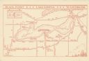
| Date: | 1922 |
|---|---|
| Description: | This map shows in red the NorthWestern Railway Line routes running from Chicago, Illinois to northern Wisconsin. The map includes cities and towns, lakes, ... |
If you didn't find the material you searched for, our Library Reference Staff can help.
Call our reference desk at 608-264-6535 or email us at: