| Date: | |
|---|---|
| Description: | Sketch of the Fort at Michilimackinac (also called Mackinac) as it was under French rule. |

| Date: | 1760 |
|---|---|
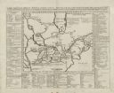
| Description: | This map shows lakes, rivers, forts, settlements, and Native American tribal territory. The southern boundary of the Hudsons Bay Company is labeled. Relief... |

| Date: | 1719 |
|---|---|
| Description: | Map of the Great Lakes and the St. Lawrence river showing French and English cities and villages, trading posts, Indian villages and tribes, portages, for... |

| Date: | 1780 |
|---|---|
| Description: | Map of North America from Lake Ontario through the Great Plains, and James Bay to Illinois. It shows rivers, lakes, and mountains in great detail, and labe... |
If you didn't find the material you searched for, our Library Reference Staff can help.
Call our reference desk at 608-264-6535 or email us at: