 Filter: Categories of Wisconsin Historical Images
Filter: Subject of Formations (Geology)
Filter: Subject of great lakes
Filter: Categories of Wisconsin Historical Images
Filter: Subject of Formations (Geology)
Filter: Subject of great lakes

| Date: | 1839 |
|---|---|
| Description: | Shows locations of cities, towns, villages, post hamlets, canals, rail and stage roads. Includes table of steamboat routes and distances; vignette of "Maid... |

| Date: | |
|---|---|
| Description: | Map reads: "The United States from the Latest Authorities". View of the states and territories. |
| Date: | |
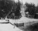
|---|---|
| Description: | The stairs and dock at the lighthouse on Rock Island. |

| Date: | |
|---|---|
| Description: | View from shoreline of boats docked at the fishing wharf. People are fishing from the pier, and a group of people are in a rowboat near a ferry. There are ... |

| Date: | 1874 |
|---|---|
| Description: | This map of Wisconsin shows cities, counties, railroads already completed and railroads projected, and geological makeup of the land such as lakes. |
If you didn't find the material you searched for, our Library Reference Staff can help.
Call our reference desk at 608-264-6535 or email us at: