 Filter: Categories of Wisconsin Historical Images
Filter: Subject of Formations (Geology)
Filter: Type of Map or Atlas
Filter: Categories of Wisconsin Historical Images
Filter: Subject of Formations (Geology)
Filter: Type of Map or Atlas

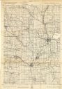
| Date: | 1902 |
|---|---|
| Description: | This map is watercolor and pen on paper and relief shown by contours. The map reads: "Contour interval 10 feet." Shown on the map are geological features a... |
| Date: | 1940 |
|---|---|
| Description: | This quadrangle collection of maps, meaning geological surveys, shows sections of central and northern Wisconsin. The maps include a quadrangle index map. ... |

| Date: | 09 01 1856 |
|---|---|
| Description: | This map is pen-and-ink and shows farm lots, other lots of land sectioned by acres, bluffs, and a coulee. Also included are notations in pencil and blue in... |

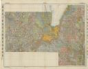
| Date: | 1906 |
|---|---|
| Description: | This topographical map shows the Little Platte River, shafts, test-pits, old workings, contour lines of Galena limestone elevation, railroads, and building... |

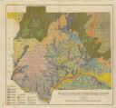
| Date: | 1915 |
|---|---|
| Description: | This map shows the extent of Wisconsin and pre-Wisconsin drift. The bottom left of the map includes a map categorizing the colors used into geologic period... |

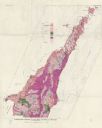
| Date: | 1911 |
|---|---|
| Description: | This map shows the soil types of towns and counties. A key of soil types is included with yellow, blue, brown, pink, orange, green, and gray. The top left ... |
| Date: | 1911 |
|---|---|
| Description: | This map shows soil types of towns and counties. A key of 14 soil types is included. The top left margin reads: "Wisconsin Geological and Natural History S... |
| Date: | 1911 |
|---|---|
| Description: | This map shows soil types, lakes, rivers, and railroads. A key of soil profiles and a legend of soil types is included. The bottom margin reads: "Soils su... |

| Date: | 1903 |
|---|---|
| Description: | This map shows lakes, rivers, railroads, and the soil types of towns and counties. A legend of soil types and conventional signs is included. Relief is sho... |

| Date: | 1947 |
|---|---|
| Description: | This map shows lakes, rivers, railroads, and the soil types of Langlade County. Legends of soil types, conventional signs, and stoniness and slope are incl... |

| Date: | 1886 |
|---|---|
| Description: | This map shows north and south ore veins, landownership, railroads, rivers, and township grid in parts of Ashland County, Wis. and Ontonagon County, Mich. ... |

| Date: | 1847 |
|---|---|
| Description: | This map identifies surveyed areas of the Upper Peninsula and shows lakes, rivers, and islands in portions of Wisconsin, Minnesota, Michigan, and upper Can... |

| Date: | 1858 |
|---|---|
| Description: | This map shows the depth of the West Channel and the different types of minerals that make up the floor bed. The steamboat range station is labeled. A note... |

| Date: | 1883 |
|---|---|
| Description: | This map shows the geology of areas in Montana, the Dakotas, Nebraska, Wyoming, Idaho, Colorado, Kansas, Arizona, New Mexico, and Utah. Map also shows lake... |

| Date: | 1994 |
|---|---|
| Description: | This map is divided and color coded by forest type. Portions of Michigan, Minnesota, Lake Michigan and Lake Superior are labeled. The reverse includes a sm... |
| Date: | 1961 |
|---|---|
| Description: | This map shows bays, lakes, and roads. Relief is shown by contours; depths are shown by isolines. Lake Michigan and Lake Winnebago are labeled. An explana... |

| Date: | 1920 |
|---|---|
| Description: | This blueprint map covers the boundary area between Lake Superior and the Lac Vieux Desert. The map reads: "Land lines, streams, lakes, railroads, cities a... |

| Date: | 10 1891 |
|---|---|
| Description: | This blueprint map shows land ownership and buildings. Text below the title reads: "The La Crosse Heights include the ridge of land with the spurs projecti... |

| Date: | 08 1960 |
|---|---|
| Description: | This map shows a detailed account of southwestern Wisconsin. Individual settlers, the type of trees that grow in given areas, the quality of the soil (labe... |

| Date: | 1949 |
|---|---|
| Description: | This map shows points of interest, historic sites, buildings, trails, roads, and general animal and plant locations. |
If you didn't find the material you searched for, our Library Reference Staff can help.
Call our reference desk at 608-264-6535 or email us at: