Filter: Categories of Wisconsin Historical Images
Filter: Subject of Forests and forestry
Filter: Subject of water
Filter: Subject of botany
Filter: Categories of Wisconsin Historical Images
Filter: Subject of Forests and forestry
Filter: Subject of water
Filter: Subject of botany
| Date: | |
|---|---|
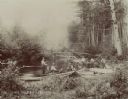
| Description: | Fisherman cooking on campfire at the edge of a river. |
| Date: | 04 26 1936 |
|---|---|
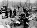
| Description: | Planting trout in Waupaca County. Left to right on bank: S.A. LaVoilette, Joe Samz, Lloyd Pinkawski, Edwin Kargewski, W.M. Geiger, G. Moder, Billy LaVoilet... |
| Date: | |
|---|---|
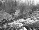
| Description: | View from shoreline towards eight men trout fishing on the Brule River. |

| Date: | 10 1852 |
|---|---|
| Description: | Landscape view of the river looking downstream from Fort Snelling, Minnesota Territory. An expanse of placid river water fills the center of the drawing an... |
| Date: | |
|---|---|
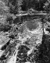
| Description: | Elevated view of the mouth of Chapel Gorge Beach showing a canoe at the shore. |
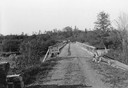
| Date: | 06 01 1936 |
|---|---|
| Description: | Bridge and truck trail constructed by Works Progress Administration (WPA) workmen to facilitate forest fire prevention and control. |
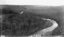
| Date: | |
|---|---|
| Description: | Aerial view of the Big Goose Neck in the Bad River at Copper Falls State Park. |

| Date: | 07 10 1949 |
|---|---|
| Description: | Aerial view of Minocqua showing the surrounding lakes. |

| Date: | 1951 |
|---|---|
| Description: | Aerial view of the Nekoosa-Edwards Paper Company nursery. |
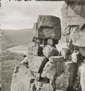
| Date: | |
|---|---|
| Description: | Devil's Lake vicinity; Boulders on top of cliff, at foot of Devil's Doorway; man on the left. |

| Date: | 1883 |
|---|---|
| Description: | Bird's-eye map of Sauk City. |

| Date: | 1902 |
|---|---|
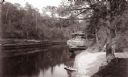
| Description: | River with distant hills behind a town. An island is in the foreground. |
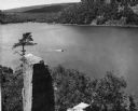
| Date: | 1948 |
|---|---|
| Description: | View from the east bluff of lake with a motorboat. A geologic pinnacle juts out from the lower left of the image. |
| Date: | |
|---|---|
| Description: | Elevated view of a bow in the river, and a homestead on the shore, with a two-story house and a barn. Two wagons are close to the barn in the lower left co... |
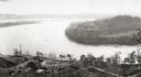
| Date: | 1945 |
|---|---|
| Description: | Elevated view of American Baptist Assembly Grounds from Judson Tower. Below near the tree-covered shoreline are buildings, a recreation area, and a harbor ... |

| Date: | 03 24 1913 |
|---|---|
| Description: | Picnic Point from the University Farm fields, now known as Observatory Hill. |
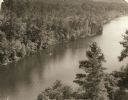
| Date: | 1940 |
|---|---|
| Description: | Elevated view of a canoe on the St. Croix River with wooded areas on both sides within the Interstate State Park. Established in 1900, Interstate Park was... |

| Date: | 1930 |
|---|---|
| Description: | Aerial view of the University of Wisconsin-Madison Arboretum including a portion of Lake Wingra and surrounding residential neighborhoods. |

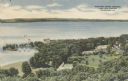
| Date: | 1910 |
|---|---|
| Description: | Aerial view of some of the 26 lakes known collectively as the Chain O' Lakes. Caption reads: "Aeroplane View of Chain O'Lakes, Waupaca, Wis." |
If you didn't find the material you searched for, our Library Reference Staff can help.
Call our reference desk at 608-264-6535 or email us at: