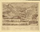
| Date: | 2007 |
|---|---|
| Description: | This map of Cedarbug is a bird's-eye map with 8 inset views and an index. The map is a print out of the original map dated 1892 held at the Cedarburg Cultu... |

| Date: | 1949 |
|---|---|
| Description: | This color map includes historical descriptions of select areas and a short article on the history of Wisconsin. The major highways in the state shown on t... |

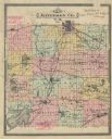
| Date: | 1896 |
|---|---|
| Description: | A hand-colored Map of Jefferson County, Wisconsin, shows township and section divisions, towns, villages and post offices, rural residents, railroads, road... |

| Date: | 1909 |
|---|---|
| Description: | A map of Langlade County, Wisconsin that shows townships and ranges, towns, cities and villages, wagon roads, churches, schools, sawmills, town halls, chee... |

| Date: | 1940 |
|---|---|
| Description: | This map of Taylor County, Wisconsin, shows the township and range grid, towns, sections, cities and villages, railroads, roads, creameries and cheese fact... |

| Date: | 1914 |
|---|---|
| Description: | This early-20th century map of Clark County, Wisconsin, shows the township and range grid, sections, cities and villages, wagon roads, railroads, settlers,... |

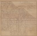
| Date: | 1928 |
|---|---|
| Description: | Shows different types of roads, railroads, schools, churches, farmsteads, cheese factories, mine shafts, old surface workings, streams, old sulphur pits, a... |

| Date: | 05 1958 |
|---|---|
| Description: | Photocopy of a map created by the City of Milwaukee Master Plan Program City Planning Division in May of 1958 representing 1870 "THE CENTRAL AREA OF THE CI... |

| Date: | |
|---|---|
| Description: | Map and advertisement for the Casa del Norte Tea Rooms, with a grid of several blocks in downtown Duluth highlighting the tea rooms as well as other notabl... |

| Date: | 1800 |
|---|---|
| Description: | This map of the Little Kaukalin Region is ink on paper and shows Little Kaukalin Rapids, Black Bird Island, buildings, trails, meadows and woods, and a sug... |

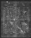
| Date: | 1900 |
|---|---|
| Description: | This photocopy map shows landownership and mills in T35N, R17W as it appeared in 1885. Rice Lake, Little Balsam Lake, and Half Moon Lake are labeled. |
If you didn't find the material you searched for, our Library Reference Staff can help.
Call our reference desk at 608-264-6535 or email us at: