 Filter: Categories of Wisconsin Historical Images
Filter: Subject of Fish hatcheries
Filter: Type of Map or Atlas
Filter: Subject of parks
Filter: Categories of Wisconsin Historical Images
Filter: Subject of Fish hatcheries
Filter: Type of Map or Atlas
Filter: Subject of parks

| Date: | 1935 |
|---|---|
| Description: | "Drott's conservation guide" map shows the locations of Indian reservations, parks, fish hatcheries, forests, lookout towers, Wisconsin Conservations Commi... |

| Date: | 1926 |
|---|---|
| Description: | A brochure with a map of Interstate Park on the Dalles of the Saint Croix River, showing locations of the north and south camp grounds, the fish hatcheries... |

| Date: | 1927 |
|---|---|
| Description: | This map includes an index and highways marked in red. Attractions on the map include: Four Mile House, Cold Springs, Grand Crossing Station, Coleman Sloug... |

| Date: | 1947 |
|---|---|
| Description: | This map shows various types of forests, nurseries, state fish hatcheries, major wood-using industries, camp & picnic grounds, fire towers, ranger stations... |
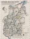
| Date: | 1950 |
|---|---|
| Description: | This map covers the fifteen counties lying in the northwestern part of the state of Wisconsin. Shows roads, railroads, state parks, cities, county boundari... |
If you didn't find the material you searched for, our Library Reference Staff can help.
Call our reference desk at 608-264-6535 or email us at: