
| Date: | 1939 |
|---|---|
| Description: | This nine-part map from the U.S. Bureau of Public Roads identifies federal and state highways in Wisconsin by pavement type. County, forest, park, and publ... |

| Date: | 1944 |
|---|---|
| Description: | This nine-part map from the U.S. Bureau of Public Roads identifies federal and state highways in Wisconsin by pavement type. County, forest, park, and publ... |

| Date: | 1950 |
|---|---|
| Description: | This road map shows federal, state and county roads in Wisconsin, northern Illinois, northeastern Iowa, eastern Minnesota, and the western portion of Michi... |

| Date: | 1943 |
|---|---|
| Description: | Advertisement for International trucks featuring a color illustration of men working with an excavator and an International dump truck on the Alcan Highway... |

| Date: | 1966 |
|---|---|
| Description: | Marchers of Obreros Unidos (United Workers) leaving Wautoma and walking towards Madison along Highway 21 to petition lawmakers to hold farms and food indus... |

| Date: | 1926 |
|---|---|
| Description: | A topographic map of Green County, showing by contours and spot heights the topographic and natural features of the county. The contour intervals are 20 fe... |

| Date: | 1931 |
|---|---|
| Description: | Page from an advertising brochure for International trucks. Two International trucks owned by the Ritter Bros. are parked on a highway construction site wh... |

| Date: | 1922 |
|---|---|
| Description: | A map of Iron County, Wisconsin, shows sections and the towns of Upson, Hurley, Hamilton, Saxon, and Mercer, lakes and streams, villages, railroads, roads ... |

| Date: | 12 25 1942 |
|---|---|
| Description: | This hand-drawn map shows the highways and features in the Rock Lake-Lake Mills area in the towns of Aztalan and Lake Mills, Jefferson County, Wisconsin. T... |
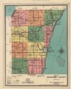
| Date: | 1946 |
|---|---|
| Description: | Map of Kewaunee County, Wisconsin, shows towns, cities and villages, roads and highways, railroads, schools, lighthouses, place names, town divisions, comm... |

| Date: | 06 1995 |
|---|---|
| Description: | "An overpass over Hwy 41 is being built for Soo Road. The camera faces west with the Tom O'Connor farm in the distance." |
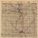
| Date: | 1926 |
|---|---|
| Description: | A map of Lincoln County, Wisconsin that shows the township and range grid, towns, cities and villages, lakes and streams, residences, churches, school hous... |
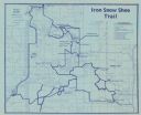
| Date: | 1970 |
|---|---|
| Description: | A map showing highlighted snowmobile trails, ice crossings, and supporting businesses in the towns of Stephenson and Silver Cliff in Marinette County and ... |

| Date: | 09 17 1959 |
|---|---|
| Description: | A map of the Menominee Indian Reservation that shows the highways, different types of roads, rivers and streams in the area. |
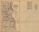
| Date: | 1922 |
|---|---|
| Description: | A road map of Milwaukee County, Wisconsin that shows the township and range system, towns, communities, completed roads, a proposed system of roads, steam ... |

| Date: | 1976 |
|---|---|
| Description: | A street map of Milwaukee County, Wisconsin that identifies the location of schools, hospitals, parks, beaches, streets, freeways, both planned or under co... |

| Date: | 1914 |
|---|---|
| Description: | A hand-drawn and colored map of the Milwaukee Township, showing how lands were used, included are parks, cemeteries, private grounds, and speculative land.... |
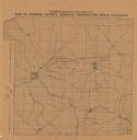
| Date: | 1912 |
|---|---|
| Description: | A map of Monroe County, Wisconsin showing townships, the towns of Sparta, Tomah, Oakdale, Wilton, Cashton, Glendale, Kendall and Wyeville, as well as the U... |

| Date: | 1925 |
|---|---|
| Description: | This 1925 map of the northern portion of Sawyer County, Wisconsin, shows the township and range system, sections, roads, railroads, and lakes and streams i... |
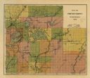
| Date: | 1926 |
|---|---|
| Description: | This 1926 map of Sawyer County, Wisconsin, the township and range system, towns, sections, cities and villages, railroads, highways and roads, and lakes an... |
If you didn't find the material you searched for, our Library Reference Staff can help.
Call our reference desk at 608-264-6535 or email us at: