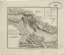
| Date: | 1761 |
|---|---|
| Description: | Map of New Orleans with north oriented towards the upper right corner. It shows the land around the city, the Mississippi River, anchorages, roads leading ... |

| Date: | 1793 |
|---|---|
| Description: | Detailed topographical map of the Ohio River between Clarkville and Louisville. It shows plots of farmland, forest, islands, garden plots, houses, Fort Fe... |
If you didn't find the material you searched for, our Library Reference Staff can help.
Call our reference desk at 608-264-6535 or email us at: