Filter: Categories of Wisconsin Historical Images
Filter: Subject of Engraving
Filter: Subject of land
Filter: Categories of Wisconsin Historical Images
Filter: Subject of Engraving
Filter: Subject of land
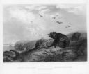
| Date: | 1832 |
|---|---|
| Description: | Herds of bison and elk on the Upper Missouri River. |

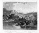
| Date: | 1832 |
|---|---|
| Description: | Fort Union, on the Missouri River in Montana. |

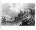
| Date: | 1832 |
|---|---|
| Description: | Fort Clark, on the Missouri River, February 1834. |
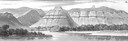
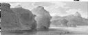
| Date: | 1832 |
|---|---|
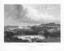
| Description: | Remarkable Hills on Upper Missouri River (view 14). |
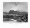
| Date: | 1832 |
|---|---|
| Description: | Remarkable hills on the Upper Missouri River (view 1). |
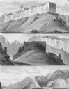
| Date: | 1832 |
|---|---|
| Description: | Remarkable hills on the Upper Missouri River (views 10, 11, and 12) |
| Date: | 1832 |
|---|---|
| Description: | View of the Stone Walls on the Upper Missouri River. Includes herd of bighorn sheep. |
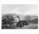
| Date: | 1832 |
|---|---|
| Description: | Herd of Bison, on the Upper Missouri River. |
| Date: | 1832 |
|---|---|
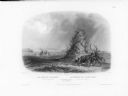
| Description: | The Elkhorn Pyramid, on the Upper Missouri River. Passing Indians would add horns to the pyramid, and sometimes add red marks to the horns to indicate the ... |
| Date: | 1832 |
|---|---|
| Description: | The White Castles, on the Upper Missouri River. |
| Date: | 1853 |
|---|---|
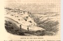
| Description: | Engraved view of miners and hillside mines in the Lead Region. Caption reads: "Sketch of the Lead Region." |
| Date: | 1884 |
|---|---|
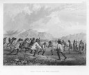
| Description: | Native Americans playing a lacrosse-like game of ball. |

| Date: | 1655 |
|---|---|
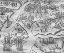
| Description: | Map of Virginia Coast based on observations by Captain John Smith. |
| Date: | 1655 |
|---|---|
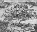
| Description: | Scene from the Laudonnière Expedition in South Carolina, ca. 1564. |
| Date: | 1655 |
|---|---|
| Description: | Scene from Laudonnière Expedition in Florida, ca. 1567. |

| Date: | 1655 |
|---|---|
| Description: | Map from Drake Expedition, ca. 1585. |

| Date: | 1655 |
|---|---|
| Description: | Map from Drake Expedition in Florida, ca. 1585. |
| Date: | 1655 |
|---|---|
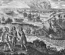
| Description: | Scene from Jamestown Settlement in Virginia, 1610. |
If you didn't find the material you searched for, our Library Reference Staff can help.
Call our reference desk at 608-264-6535 or email us at: