Filter: Categories of Wisconsin Historical Images
Filter: Subject of Engraving
Filter: Subject of indians of north america
Filter: Subject of children
Filter: Categories of Wisconsin Historical Images
Filter: Subject of Engraving
Filter: Subject of indians of north america
Filter: Subject of children
| Date: | |
|---|---|
| Description: | Photograph of an engraving from an unknown source depicting a group of Native American warriors herding white captives along a trail. A building burns in ... |
| Date: | 1832 |
|---|---|
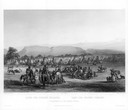
| Description: | Funeral of a Sioux Chief near Fort Pierre. |
| Date: | 1832 |
|---|---|
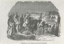
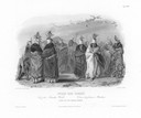
| Description: | Ptihn-Tak-Ochatä, or dance of the Mandan women. |
| Date: | 1832 |
|---|---|
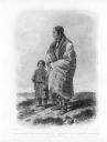
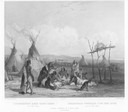
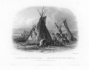
| Description: | A skin lodge of an Assiniboin Chief. The engraving includes a man on horseback and a dog harnessed to a travois. |
| Date: | 1655 |
|---|---|
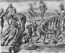
| Description: | Engraving made after a painting by Jacques Le Moyne de Morgues (died 1588) while on the Laudonnière Expedition in Florida, ca. 1564. |

| Date: | 1784 |
|---|---|
| Description: | Plate 42. Scene from Cook's Third Expedition, 1776-1779, while in Alaska. |

| Date: | 1784 |
|---|---|
| Description: | Plate 58. Scene from Cook's Third Expedition, 1776-1779, while in Alaska. |
| Date: | 1884 |
|---|---|
| Description: | A engraving of the artist's conception of Pawnees torturing a female captive in the Morning Star Sacrifice ceremony. |
| Date: | 1855 |
|---|---|
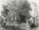
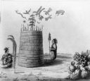
| Description: | An illustration of an Indian prophet standing by his lodge, which has symbols drawn on and floating above it. Others are seated, watching him. Two persons ... |
| Date: | 1884 |
|---|---|
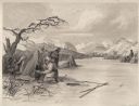
| Description: | Small group of Native Americans spearing fish through ice on a river. Mountains can be seen in the background. |

| Date: | 1746 |
|---|---|
| Description: | Map of North America from the southern portion of James Bay to Florida. It shows the colonies, cities, Native American land, and topological and geographic... |

| Date: | 1683 |
|---|---|
| Description: | Map of the north east coast of North America showing islands, regions, Native American land, bays, and a few European settlements. The Great Lakes appear i... |

| Date: | 1710 |
|---|---|
| Description: | Map of North America showing the European claims, Native American land and villages, rivers, lakes, cities, and notes on explorers, discoveries, and topogr... |

| Date: | 1719 |
|---|---|
| Description: | Map of North America showing land divisions between France, Spain, England, Sweden, Denmark and Holland. The map is detailed, labeling cities, forts, islan... |
If you didn't find the material you searched for, our Library Reference Staff can help.
Call our reference desk at 608-264-6535 or email us at: