 Filter: Categories of Wisconsin Historical Images
Filter: Subject of Education
Filter: Year of 1800-1899
Filter: Year of 1850-1859
Filter: Categories of Wisconsin Historical Images
Filter: Subject of Education
Filter: Year of 1800-1899
Filter: Year of 1850-1859

| Date: | 1858 |
|---|---|
| Description: | Portrait of William Freeman Vilas (1840-1908), Civil War and United States Senator, taken while he was a student at the University of Wisconsin. |
| Date: | 1852 |
|---|---|
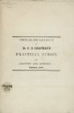
| Description: | Circular and catalogue advertising Dr. Chandler B. Chapman's "Practical School for Anatomy and Surgery." Madison, 1852. |
| Date: | 1856 |
|---|---|
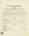
| Description: | Prospectus for the Madison Female Seminary, then operated by Joseph C. Pickard. |
| Date: | 1851 |
|---|---|
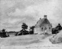
| Description: | School and church, from a drawing by Johann B. Wengler, an Austrian traveller in this country. |
| Date: | 1858 |
|---|---|
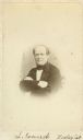
| Description: | Vignetted carte-de-visite portrait of Laurits Esmark (1806-1884), Norwegian Zoologist. Esmark served as a professor of Zoology at Christiania University in... |
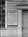
| Date: | 1854 |
|---|---|
| Description: | A plaque on the exterior of the building declares the birthplace of the Republican Party. |

| Date: | 1858 |
|---|---|
| Description: | This 1858 map of Racine County, Wisconsin, shows land ownership and acreages, the township and range grid, towns, cities and villages, roads, railroads, sc... |

| Date: | 1859 |
|---|---|
| Description: | Shows townships and sections, landownership, roads, railroads, rural residences, schools, churches, and topography. Relief shown by hachures. "From governm... |

| Date: | 1858 |
|---|---|
| Description: | This 1858 map of Rock County, Wisconsin, shows the township and range grid, towns, sections, cities and villages, railroads, roads, property owners and res... |

| Date: | 1857 |
|---|---|
| Description: | Map of La Crosse County, Wisconsin showing village plat, farm houses, schools, roads, railroads, township names (New Amsterdam, Dacota, Minnesota, Driesbac... |

| Date: | 1859 |
|---|---|
| Description: | This map show plats including plat names, plat numbers, and some lot owner's names. Relief is shown by hachures. The map includes line drawings of Juneau B... |

| Date: | 1852 |
|---|---|
| Description: | Sixth plate daguerreotype of Azel Parkhurst Ladd (1811-1854). Ladd was the Wisconsin state superintendent of public instruction in 1852. Oval-framed quarte... |

| Date: | 1857 |
|---|---|
| Description: | This map shows lot and block numbers, wards, roads, railroads, some landowners’ names, and selected buildings. The map includes an inset map of Glidden & L... |

| Date: | 1857 |
|---|---|
| Description: | This map shows lot and block numbers, wards, roads, railroads, some landowners’ names, and selected buildings. Lake Michigan, the Milwaukee River, and Glid... |

| Date: | 1857 |
|---|---|
| Description: | This map shows lot and block numbers, wards, roads, railroads, some landowners’ names, and selected buildings. Lake Michigan, the Milwaukee River, and Glid... |

| Date: | 1858 |
|---|---|
| Description: | This map is hand-colored and mounted on cloth and shows lot and block numbers and dimensions, landownership, streets, railroads, selected buildings, fair g... |

| Date: | 01 1856 |
|---|---|
| Description: | This map shows lots, lots appropriated for churches and schools, streets, parks, court house, and land to be appropriated for railroad depots. An inset map... |

| Date: | 1858 |
|---|---|
| Description: | This map shows lot and block numbers, landownership, buildings, railroads, roads, wards, points of interest, parks, and cemeteries. Also included are illus... |

| Date: | 1857 |
|---|---|
| Description: | This map shows lot and block numbers, buildings, some land ownership, wards, waterways, streets, railroads, brick yards, and cemeteries. It includes an ind... |

| Date: | 1856 |
|---|---|
| Description: | This map shows the city as planned by the General Colonization Society, including streets, land parcels, two subdivisions of out-lots with graveyard, schoo... |
If you didn't find the material you searched for, our Library Reference Staff can help.
Call our reference desk at 608-264-6535 or email us at: