| Date: | 1876 |
|---|---|
| Description: | Map of home and land, with the roads, lakes, railroad, and buildings. |

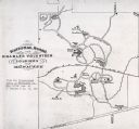
| Date: | 1836 |
|---|---|
| Description: | This map shows settlers houses and businesses, trails, and swamps. The relief is shown by hachures. The map includes illustrations of historical buildings ... |

| Date: | 1890 |
|---|---|
| Description: | Map of Milwaukee as remembered by "Dr Enoch Chase, U.B. Smith & Others." Represented are major roads, lowlands, trails, homesteads, and lots. Map depicts t... |

| Date: | 1840 |
|---|---|
| Description: | Pen-and-ink on paper. Map shows 1840’s homes with owner names, a Native American cemetery, and other points of interest. Relief shown by hachures. Oriented... |

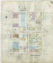
| Date: | 1910 |
|---|---|
| Description: | A Sanborn insurance map of a section of Milwaukee, including East Clybourn and East Buffalo Streets. "Italian Section 3/4/30" is written on the page in blu... |

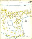
| Date: | 1910 |
|---|---|
| Description: | Sanborn insurance map of Milwaukee showing a portion of Jones Island with Lake Michigan at the top and the Milwaukee River at the bottom. |
If you didn't find the material you searched for, our Library Reference Staff can help.
Call our reference desk at 608-264-6535 or email us at: