Filter: Categories of Wisconsin Historical Images
Filter: Subject of Deserts
Filter: Subject of water
Filter: Categories of Wisconsin Historical Images
Filter: Subject of Deserts
Filter: Subject of water
| Date: | |
|---|---|
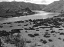
| Description: | The site of Elephant Butte Dam prior to construction of the dam showing desert hills and the Rio Grande River. Construction was completed in 1916, and at t... |
| Date: | 1893 |
|---|---|
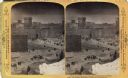
| Description: | A depiction of Jerusalem on the day of Jesus' crucifixion. In the background, there is Herodian architecture and the Hezekiah's Pool.Text at right: "Wander... |
| Date: | 1893 |
|---|---|
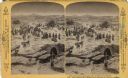
| Description: | A depiction of Jerusalem on the day of Jesus' crucifixion. Mount Mizpeh and Emmaus are in the distance. Text at right: "Wanderings Among the Wonders and Be... |
| Date: | 1893 |
|---|---|
| Description: | A replication of the crucifixion of Jesus Christ. Depicted is the Damascus Road, the site where Saint Paul is believed to have converted to Christianity. T... |
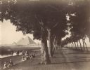
| Date: | 1890 |
|---|---|
| Description: | View down road lined with trees in Egypt. A group of Egyptians are standing and sitting between the trees and the river, and travelers on the road are walk... |
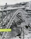
| Date: | 1959 |
|---|---|
| Description: | An International truck sits on a bridge spanning Glen Canyon and the Colorado River. |

| Date: | 1929 |
|---|---|
| Description: | An International truck pours 30-foot sections of a lock. |
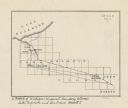
| Date: | |
|---|---|
| Description: | This map shows the Michigan-Wisconsin boundary in Iron, Vilas, and Forest counties, Wisconsin, and Gogebic and Iron counties, Michigan. The Montreal River... |

| Date: | 1978 |
|---|---|
| Description: | A man driving a yellow and black International Scout II up the steep and sandy bank of a river. The spinning wheels are kicking up water and sand. |

| Date: | 1929 |
|---|---|
| Description: | Three men working with an oxen to draw water from a well with a skin bucket. The well has a stone structure holding the pulley. |

| Date: | 1920 |
|---|---|
| Description: | This blueprint map covers the boundary area between Lake Superior and the Lac Vieux Desert. The map reads: "Land lines, streams, lakes, railroads, cities a... |

| Date: | 1778 |
|---|---|
| Description: | Detailed map of the Chesapeake Bay region and surrounding states. It shows a detailed account of the borders, cities, towns, islands, swamps, mountains, ri... |
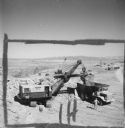
| Date: | 1957 |
|---|---|
| Description: | Elevated view of a crane loading an International Payhauler for earth removal. One man is standing near the crane on the left, and another man is standing ... |
If you didn't find the material you searched for, our Library Reference Staff can help.
Call our reference desk at 608-264-6535 or email us at: