 Filter: Categories of Wisconsin Historical Images
Filter: Subject of Dams
Filter: Year of 1900-1999
Filter: Type of Map or Atlas
Filter: Categories of Wisconsin Historical Images
Filter: Subject of Dams
Filter: Year of 1900-1999
Filter: Type of Map or Atlas

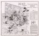
| Date: | 1907 |
|---|---|
| Description: | Topographic map of the Wisconsin River done under direction of Daniel Meade for construction of the Kilbourn dam by the Southern Wisconsin Power Company. I... |

| Date: | 1907 |
|---|---|
| Description: | Topographic map of the Wisconsin River done under direction of Daniel Meade for construction of the Kilbourn dam by the Southern Wisconsin Power Company. I... |

| Date: | 1926 |
|---|---|
| Description: | This hand-colored blueprint map shows landowners in part of T15N, R5E in Juneau County. North is oriented to the right. |

| Date: | 1941 |
|---|---|
| Description: | A tourist map of Marinette County, Wisconsin that includes indexes of the lakes and rivers in the county which also identify the fish present, a list of ra... |

| Date: | 1902 |
|---|---|
| Description: | This 1902 map of the eastern portion of Sawyer County, Wisconsin, shows the township and range system, sections, roads, farm houses, camps, school houses, ... |

| Date: | 1909 |
|---|---|
| Description: | This 1909 map of Taylor County, Wisconsin, shows the township and range grid, towns, sections, cities and villages, settlers houses, schools, churches, saw... |

| Date: | 02 1956 |
|---|---|
| Description: | This 1956 map of Waukesha County, Wisconsin, shows the township and range grid, towns, sections, cities and villages, roads, railroads, dams, airports, par... |

| Date: | 1960 |
|---|---|
| Description: | This manuscript map of Taylor County, Wisconsin, shows the township and range grid, lakes and streams, "Chippewa trails, Indian trails" Indian villages and... |

| Date: | 1900 |
|---|---|
| Description: | Shows limits of drainage basin, dams, rapids, roads, and railroads in parts of Iron and Vilas Counties, Wisconsin. From the E.P. Sherry papers relating to ... |

| Date: | 1976 |
|---|---|
| Description: | Panel title. Shows railroads, roads, highways, boundaries, dams, public hunting and fishing grounds, cemeteries, forest ranger stations, plant life, and s... |

| Date: | 11 15 1957 |
|---|---|
| Description: | This map shows single family residence district, business district, and manufacturing district, as well as block and lot numbers, Hustis Homestead, gravel ... |
| Date: | 1987 |
|---|---|
| Description: | This map shows reservoirs, drainage areas, and parts of of Lincoln, Langlade, Forest, Oneida, and Vilas counties. Includes 1 inset map of corrections for R... |

| Date: | 01 1969 |
|---|---|
| Description: | A map of Oneida county, which includes a small drawing of a hodag. |

| Date: | 1910 |
|---|---|
| Description: | This blue print map shows original lakes, area to be covered by Chippewa Flowage (flow-lines for contours 1310 and 1315), dam sites, roads, and buildings. |

| Date: | 06 12 1929 |
|---|---|
| Description: | This manuscript blueprint shows buildings with the names of their owners, tabernacle, location "where Strang found plates" and "house where Strang died," a... |

| Date: | 1951 |
|---|---|
| Description: | This map shows land use, dwellings, resorts, camps, marshes, springs, dams, lake bottom composition, and access. The map includes a fish species table, geo... |

| Date: | 1939 |
|---|---|
| Description: | This map originally dated March 18, 1920 and revised for this edition. The map shows the original meander line of 'Shebowegan Lake' established by 1850 sur... |

| Date: | 1975 |
|---|---|
| Description: | This map shows nature trails, public attractions, public hunting and fishing grounds, dams, waysides, lakes, highways, and roads. The upper right corner in... |
| Date: | 1971 |
|---|---|
| Description: | This map shows major tributaries, and also covers parts of Marathon and Portage Counties. |

| Date: | 01 01 1959 |
|---|---|
| Description: | This map shows many of the rivers, dams, bays, harbors, lakes, and canals. It includes an index of authorized federal project, both for navigation and floo... |
If you didn't find the material you searched for, our Library Reference Staff can help.
Call our reference desk at 608-264-6535 or email us at: