 Filter: Categories of Wisconsin Historical Images
Filter: Subject of Dams
Filter: Year of 1800-1899
Filter: Categories of Wisconsin Historical Images
Filter: Subject of Dams
Filter: Year of 1800-1899

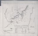
| Date: | 1846 |
|---|---|
| Description: | This plat map, which features the very early spelling of Wisconsin as "Wiskonsin", was created sometime between 1846 and 1854 and shows a canal and dam on ... |

| Date: | 1861 |
|---|---|
| Description: | This map shows townships and sections, landownership, roads, railroads, rural residences, schools, churches, and topography. Also included are inset maps o... |
| Date: | 1897 |
|---|---|
| Description: | This map shows the distances along Fox River, as well as adjacent lakes and railroads, between Green Bay and the Wisconsin River. Lake Michigan is on the f... |

| Date: | 1875 |
|---|---|
| Description: | This blue line print map shows completed and proposed dams, completed and proposed shore protections, and completed spurs. The map covers the river between... |
If you didn't find the material you searched for, our Library Reference Staff can help.
Call our reference desk at 608-264-6535 or email us at: