
| Date: | 02 1956 |
|---|---|
| Description: | This 1956 map of Waukesha County, Wisconsin, shows the township and range grid, towns, sections, cities and villages, roads, railroads, dams, airports, par... |

| Date: | 1875 |
|---|---|
| Description: | One of a set of maps from G.K. Warren's 1876 Report on the transportation route along the Wisconsin and Fox rivers in the State of Wisconsin between the Mi... |

| Date: | 11 30 1882 |
|---|---|
| Description: | This 1882 manuscript map shows the improvements to a 12-mile stretch of the Wisconsin River below Portage, in Columbia County, Wisconsin. Recent improvemen... |
| Date: | 1873 |
|---|---|
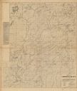
| Description: | This 1873 map of Chippewa County, Wisconsin, which at the time also encompassed all or part of Price, Rusk, Sawyer, and Taylor counties, shows the township... |

| Date: | 1960 |
|---|---|
| Description: | This manuscript map of Taylor County, Wisconsin, shows the township and range grid, lakes and streams, "Chippewa trails, Indian trails" Indian villages and... |

| Date: | 1840 |
|---|---|
| Description: | This manuscript map by Increase Lapham shows the railroads, roads, wetlands, lakes and streams, dams, prairies, and settlers in the eastern half of Waukesh... |
| Date: | 1866 |
|---|---|
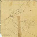
| Description: | This manuscript map by Increase Lapham shows the Dells of the Wisconsin River, from Stand Rock and Witches Gulch at the north to a point approximately one ... |

| Date: | 1900 |
|---|---|
| Description: | Shows limits of drainage basin, dams, rapids, roads, and railroads in parts of Iron and Vilas Counties, Wisconsin. From the E.P. Sherry papers relating to ... |

| Date: | 1976 |
|---|---|
| Description: | Panel title. Shows railroads, roads, highways, boundaries, dams, public hunting and fishing grounds, cemeteries, forest ranger stations, plant life, and s... |

| Date: | 1877 |
|---|---|
| Description: | Relief shown by hachures. Shows land ownership by name, wards, railroads, mills, dams, city limits, Chippewa River, and Half Moon Lake. Includes index of m... |

| Date: | 1877 |
|---|---|
| Description: | Relief shown by hachures. Shows land ownership by name, wards, railroads, mills, dams, city limits, Chippewa River, and Half Moon Lake. Includes index of m... |

| Date: | 1889 |
|---|---|
| Description: | Shows city limits, railroads, mills, schools, cemeteries, dams, parks, lumber yards, log canals, log reservoir, Chippewa River, Eau Claire River, and Half ... |

| Date: | 1828 |
|---|---|
| Description: | Map of the Louisville and Portland Canal on the Ohio River. The map shows Louisville, Shippingsport, Clarksville, Jeffersonville, Gravel Island, Corn Islan... |
| Date: | 1890 |
|---|---|
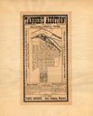
| Description: | This map is a plat map and shows government buildings, churches, Klein’s Park, and the government dam in Kaukauna. The map includes text about Kaukauna wit... |

| Date: | 1846 |
|---|---|
| Description: | This plat map, which features the very early spelling of Wisconsin as "Wiskonsin", was created sometime between 1846 and 1854 and shows a canal and dam on ... |

| Date: | 11 15 1957 |
|---|---|
| Description: | This map shows single family residence district, business district, and manufacturing district, as well as block and lot numbers, Hustis Homestead, gravel ... |
| Date: | 1987 |
|---|---|
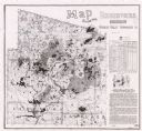
| Description: | This map shows reservoirs, drainage areas, and parts of of Lincoln, Langlade, Forest, Oneida, and Vilas counties. Includes 1 inset map of corrections for R... |
| Date: | 01 1969 |
|---|---|
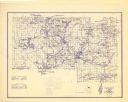
| Description: | A map of Oneida county, which includes a small drawing of a hodag. |

| Date: | 1910 |
|---|---|
| Description: | This blue print map shows original lakes, area to be covered by Chippewa Flowage (flow-lines for contours 1310 and 1315), dam sites, roads, and buildings. |

| Date: | 1861 |
|---|---|
| Description: | This map shows townships and sections, landownership, roads, railroads, rural residences, schools, churches, and topography. Also included are inset maps o... |
If you didn't find the material you searched for, our Library Reference Staff can help.
Call our reference desk at 608-264-6535 or email us at: