 Filter: Categories of Wisconsin Historical Images
Filter: Subject of College buildings
Filter: Type of Map or Atlas
Filter: Subject of transportation
Filter: Categories of Wisconsin Historical Images
Filter: Subject of College buildings
Filter: Type of Map or Atlas
Filter: Subject of transportation

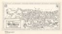
| Date: | 1949 |
|---|---|
| Description: | Color bird's-eye map of the University of Wisconsin-Madison as it was midcentury, with two co-eds, several photographs of campus landmarks around edges, an... |

| Date: | 1959 |
|---|---|
| Description: | University of Wisconsin-Madison campus. Numbers in circles identify buildings across campus with the building index. Black arrows point out important infor... |

| Date: | 1929 |
|---|---|
| Description: | Shows fraternities, sororities, major rooming houses, private and university buildings, and university property. Oriented with north slightly to the right. |

| Date: | 1950 |
|---|---|
| Description: | Includes building index and "To Help You Locate Buildings" text. Index includes campus buildings and points of interest. Aerial view on verso. |

| Date: | 1976 |
|---|---|
| Description: | Indexed map of campus buildings, streets, and residence halls. Also included on the map is information about buses. The back of the map features campus bus... |

| Date: | 1889 |
|---|---|
| Description: | This map shows a plat of city, city limits, numbered blocks, numbered lots, wards, local streets, roads, railroads, street railways, fire limits, hydrants,... |

| Date: | 1902 |
|---|---|
| Description: | Madison Sanborn map, including Langdon and State Streets. |

| Date: | 1908 |
|---|---|
| Description: | A detail of a Madison Sanborn map that includes the University of Wisconsin Boat House, UW Gymnasium & Armory (The Red Gym), fraternity houses, and the YMC... |
| Date: | 04 1904 |
|---|---|
| Description: | This map is pen and pencil on paper and shows local streets, and the following University of Wisconsin-Madison buildings: the Main Hall, South Hall, North ... |

| Date: | 1920 |
|---|---|
| Description: | This blue print map and blue line print copy mounted on cloth shows land ownership by name, campus buildings, local streets, railroads, and part of Lake Me... |
| Date: | 1972 |
|---|---|
| Description: | This bird’s-eye-view map shows campus buildings labeled by name or academic department, local streets, and part of Lake Mendota. Relief is shown pictorial... |

| Date: | 1912 |
|---|---|
| Description: | This manuscript blueprint map shows numbered buildings and manuscript annotations. Lake Mendota and streets are labeled. |

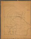
| Date: | 1912 |
|---|---|
| Description: | This manuscript blueprint map shows land conditions for future construction development on the University of Wisconsin-Madison campus. It highlights roads ... |

| Date: | 1926 |
|---|---|
| Description: | This blueprint map is oriented with north to the upper left. The map shows buildings with note of those "to be torn down," sidewalks, proposed power plant,... |
If you didn't find the material you searched for, our Library Reference Staff can help.
Call our reference desk at 608-264-6535 or email us at: