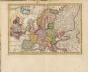
| Date: | 1740 |
|---|---|
| Description: | From Weigel's Atlas portatilis, oder, Compendieuse Vorstellung der gantzen Welt. Map of Europe. |

| Date: | 1740 |
|---|---|
| Description: | Engraved and hand-colored map of the Iberian peninsula as a theater of war during the War of the Spanish Succession (1701-1714). The map is dedicated to Ki... |

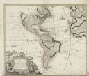
| Date: | 1746 |
|---|---|
| Description: | Detailed map of the western hemisphere and part of Africa and Europe. Islands, cities, settlements, rivers, lakes, countries, and regions are marked. Mount... |

| Date: | 1740 |
|---|---|
| Description: | Map including the regions and cities of the northern half of North America. Native American land, rivers, lakes, mountains are labeled. Mountains, marshes,... |
If you didn't find the material you searched for, our Library Reference Staff can help.
Call our reference desk at 608-264-6535 or email us at: