Filter: Categories of Wisconsin Historical Images
Filter: Subject of Cities and towns
Filter: Subject of farms
Filter: Categories of Wisconsin Historical Images
Filter: Subject of Cities and towns
Filter: Subject of farms

| Date: | 1873 |
|---|---|
| Description: | Main Street, with its dirt, ruts, cows (and presumably manure), but wide enough for easy hitching of wagons and teams. |
| Date: | 1900 |
|---|---|
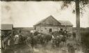
| Description: | Barnyard scene on the Rollo Shurfelt farm with people milking the cows. Several horses are in the yard as well. |
| Date: | 05 27 1961 |
|---|---|
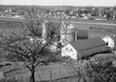
| Description: | A view overlooking the edge of the town, taken from an eastern slope, with a farm and cows in the foreground. |

| Date: | 1890 |
|---|---|
| Description: | Bird's-eye map of West Superior and Superior, with insets of Wright Farm and First Building in Superior. |
| Date: | 1900 |
|---|---|
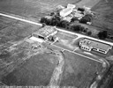
| Description: | Wetland, grassy pasture, ring fence are part of the College of Agriculture Farm on the University of Wisconsin Madison campus. |
| Date: | 1900 |
|---|---|
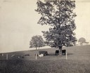
| Description: | Fenced-in, the cattle find a grassy pasture of Observatory Hill below Washburn Observatory on the University of Wisconsin-Madison campus. |
| Date: | 1873 |
|---|---|
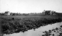
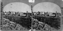
| Description: | View across field towards the Amund Rustebakke farm. Twelve haystacks dominate the left and center of the image, and two people are standing on top of the ... |

| Date: | |
|---|---|
| Description: | Wisconsin threshing crew, with steam operated tractor, in Buffalo county. |

| Date: | 1943 |
|---|---|
| Description: | This photocopy map shows inhabited farms, rivers, roads, and mills in the vicinity of Marathon City [and village of Edgar], including area between the Big ... |
| Date: | 1875 |
|---|---|
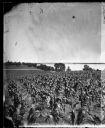
| Description: | View from Southeast shore of Lake Monona across a cornfield, perhaps on the farm of Thomas Williamson. |

| Date: | 09 10 1875 |
|---|---|
| Description: | View looking west across the area once occupied by Camp Randall during the Civil War and towards the Breese Stevens farm property. The Madison Centennial ... |
| Date: | 1876 |
|---|---|
| Description: | Probably one of the "Three different views of the village of Argyle, Wis." mentioned in Dahl's 1877 "Catalogue of Stereoscopic Views." Two men sit in a hay... |
| Date: | 1876 |
|---|---|
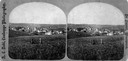
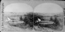
| Description: | Probably one of the "Three different views of the village of Argyle, Wis." mentioned in Dahl's 1877 "Catalogue of Stereoscopic Views." A view of the town a... |
| Date: | 1876 |
|---|---|
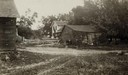
| Description: | Probably one of the "Three different views of the village of Argyle, Wis." mentioned in Dahl's 1877 "Catalogue of Stereoscopic Views." In the foreground is... |
| Date: | 06 1925 |
|---|---|
| Description: | View of three farm buildings - the one in the center is collapsing. |
| Date: | 1920 |
|---|---|
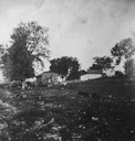
| Description: | View of a rocky pasture with some small, distant farm buildings, and a few farm animals grazing. |
| Date: | 1920 |
|---|---|
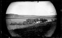
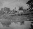
| Description: | View of farm buildings in the background on the top of a hill, with the shore of the lake in the foreground. |
If you didn't find the material you searched for, our Library Reference Staff can help.
Call our reference desk at 608-264-6535 or email us at: