 Filter: Categories of Wisconsin Historical Images
Filter: Subject of Church buildings
Filter: Type of Map or Atlas
Filter: Categories of Wisconsin Historical Images
Filter: Subject of Church buildings
Filter: Type of Map or Atlas

| Date: | 1928 |
|---|---|
| Description: | Shows different types of roads, railroads, schools, churches, farmsteads, cheese factories, mine shafts, old surface workings, streams, old sulphur pits, a... |

| Date: | 1911 |
|---|---|
| Description: | Shows roads, railroads, post offices, schools, houses, churches, and routes. Includes distant chart and explanation. "Price 35 cents"--Upper left margin. "... |

| Date: | 1863 |
|---|---|
| Description: | Includes index to public buildings, churches, schools. Inset: Glidden & Lockwood’s addition. Gives names of some property owners. |

| Date: | 05 1958 |
|---|---|
| Description: | Photocopy of a map created by the City of Milwaukee Master Plan Program City Planning Division in May of 1958 representing 1870 "THE CENTRAL AREA OF THE CI... |

| Date: | 1880 |
|---|---|
| Description: | Map created from original drawing and surveys taken by Silas Chapman. Bottom right corner features a reference key. There is a street guide on the left sid... |

| Date: | 1891 |
|---|---|
| Description: | This maps has an index of depots, hotels, prominent institutions and buildings, churches, and places of amusement. The map was removed from an unidentified... |

| Date: | 1940 |
|---|---|
| Description: | Map features advertisements for local businesses on the left and bottom. Map includes a "LEGEND" and "DIRECTORY OF CHURCHES". Streets are labeled as are so... |

| Date: | 1893 |
|---|---|
| Description: | Bird’s-eye view of Depere looking North. Includes illustrations and an index to points of interest. |

| Date: | 1914 |
|---|---|
| Description: | Includes index of University of Wisconsin buildings, churches, and public buildings. Top of Map reads: '"GET A SQUARE DEAL" AT THE COLLEGE BOOK STORE SHOWN... |

| Date: | 1912 |
|---|---|
| Description: | Shows wards, sections, plat additions, selected buildings, churches, schools, and manufacturing companies. "We have revised this map from H. McCallum’s 189... |

| Date: | 1874 |
|---|---|
| Description: | Includes index to key buildings. Shows local streets, railroads, fairgrounds, mills, schools, churches, and part of Lake Winnebago. Streets running west to... |

| Date: | 1916 |
|---|---|
| Description: | Includes index to businesses, churches, and schools. Shows local streets, buildings, railroads, ward divisions, Fond du Lac River, and part of Lake Winneba... |

| Date: | 1800 |
|---|---|
| Description: | Shows plat of town, land ownership by name, local streets, courthouses, churches, hotels, mills, railroads, railroad stations, lakes, and rivers. Includes ... |

| Date: | 1888 |
|---|---|
| Description: | Shows ward divisions and street railways, as well as University of Wisconsin buildings, churches, and schools. Cataloged from copy with right and left edge... |

| Date: | 1910 |
|---|---|
| Description: | Map shows routes, post offices, churches, schools, houses, and roads on the rural delivery service route in blue lines. An explanation key appears on the l... |
| Date: | 1911 |
|---|---|
| Description: | Map shows routes, post offices, houses, churches, schools, and roads of La Fayette County rural delivery service. The map margins read: "G. January 11, 191... |

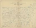
| Date: | 1908 |
|---|---|
| Description: | Map shows townships and sections, landownership and acreages, rural routes, roads, railroads, creameries, churches, schools, and town halls. Sections appea... |

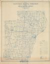
| Date: | 1872 |
|---|---|
| Description: | Shows townships and sections, landownership and acreages, roads, railroads, churches, schools, and cemeteries. Includes business directories of Manitowoc ... |
| Date: | 1911 |
|---|---|
| Description: | Shows routes, post offices, schools, churches, houses, roads, and collection boxes of the rural delivery service of Manitowoc County. Bottom margins read:... |

| Date: | 1903 |
|---|---|
| Description: | Map shows railroads, roads, street car lines, schools, churches, cemeteries, town halls, and railroad stations. Includes inset lists of: Population of Milw... |
If you didn't find the material you searched for, our Library Reference Staff can help.
Call our reference desk at 608-264-6535 or email us at: