| Date: | 06 12 1929 |
|---|---|
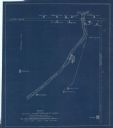
| Description: | This manuscript blueprint shows buildings with the names of their owners, tabernacle, location "where Strang found plates" and "house where Strang died," a... |

| Date: | 1905 |
|---|---|
| Description: | This photocopied map shows landownership, roads, railroads, rural mail routes, churches, school houses, cemeteries, and townships. The map includes adverti... |

| Date: | 1902 |
|---|---|
| Description: | This map shows townships, land parcels, schools, rivers, lakes, creameries, churches, cemeteries, roads, post offices, town halls, saw mills, roads and sto... |

| Date: | 1904 |
|---|---|
| Description: | Map showing lots, additions, and wards within the city limits, as well as some landownership. The streets are labeled, as is Lake Winnebago, rivers, railro... |

| Date: | 1874 |
|---|---|
| Description: | Birds-eye view of Appleton Wisconsin. In the foreground are people fishing, strolling, and looking over the canal towards the Fox River. Streets and buildi... |

| Date: | 1887 |
|---|---|
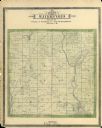
| Description: | A plat map of Waterford. Township 4, North Range 19, East of 4th Principal Meridian. References at bottom include school houses, houses, churches and cemet... |
If you didn't find the material you searched for, our Library Reference Staff can help.
Call our reference desk at 608-264-6535 or email us at: