| Date: | 04 1981 |
|---|---|
| Description: | View of the Graceland Cemetery. There are houses in the background and trees scattered throughout the plots. |

| Date: | 1925 |
|---|---|
| Description: | Elevated view of Coon Valley from a hilltop. Trees are on either side of the frame. In the city, there is a cemetery, church, and field of crops. |

| Date: | 1870 |
|---|---|
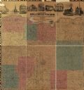
| Description: | A map of Iowa County, Wisconsin mounted on cloth that shows the villages of Avoca, Mifflin, Linden, Arena, Helena Station, Highland, Dodgeville, as well as... |

| Date: | 1840 |
|---|---|
| Description: | Pen-and-ink on paper. Map shows 1840’s homes with owner names, a Native American cemetery, and other points of interest. Relief shown by hachures. Oriented... |

| Date: | 06 12 1929 |
|---|---|
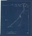
| Description: | This manuscript blueprint shows buildings with the names of their owners, tabernacle, location "where Strang found plates" and "house where Strang died," a... |
If you didn't find the material you searched for, our Library Reference Staff can help.
Call our reference desk at 608-264-6535 or email us at: