| Date: | 1867 |
|---|---|
| Description: | Drawn map showing planned development of Cornell, including a couple of schools, Oakwood cemetery, the public square, and several bridges and dams. |

| Date: | 1976 |
|---|---|
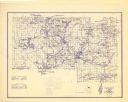
| Description: | Panel title. Shows railroads, roads, highways, boundaries, dams, public hunting and fishing grounds, cemeteries, forest ranger stations, plant life, and s... |

| Date: | 11 15 1957 |
|---|---|
| Description: | This map shows single family residence district, business district, and manufacturing district, as well as block and lot numbers, Hustis Homestead, gravel ... |

| Date: | 01 1969 |
|---|---|
| Description: | A map of Oneida county, which includes a small drawing of a hodag. |

| Date: | 06 12 1929 |
|---|---|
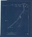
| Description: | This manuscript blueprint shows buildings with the names of their owners, tabernacle, location "where Strang found plates" and "house where Strang died," a... |
If you didn't find the material you searched for, our Library Reference Staff can help.
Call our reference desk at 608-264-6535 or email us at: