 Filter: Categories of Wisconsin Historical Images
Filter: Subject of Cemeteries
Filter: Subject of cities and towns
Filter: Categories of Wisconsin Historical Images
Filter: Subject of Cemeteries
Filter: Subject of cities and towns

| Date: | 1876 |
|---|---|
| Description: | This 1876 map of Saint Croix County, Wisconsin, shows the township and range grid, sections, towns, cities and villages, land ownership and acreages, wagon... |

| Date: | 1877 |
|---|---|
| Description: | This 1877 map of Sauk County, Wisconsin, shows the township and range grid, sections, towns, cities and villages, land ownership and acreages, wagon roads,... |

| Date: | 1977 |
|---|---|
| Description: | This 1977 map identifies the locations of 100 cemeteries in Sheboygan County, Wisconsin. Cemeteries are listed by town. |

| Date: | 1920 |
|---|---|
| Description: | This map shows the township and range system, sections, schools, churches, cemeteries, town halls, roads, railroads, and lakes and streams in Shawano Count... |

| Date: | 1862 |
|---|---|
| Description: | This 1862 map of Sheboygan County, Wisconsin, shows land ownership and acreages, the township and range grid, towns, cities and villages, roads, railroads,... |
| Date: | 1900 |
|---|---|
| Description: | This map of Taylor County, Wisconsin, shows landownership, the township and range grid, towns, sections, cities and villages, railroads, tanneries, cemeter... |

| Date: | 1878 |
|---|---|
| Description: | This 1878 map of Vernon County, Wisconsin, shows the township and range grid, sections, towns, cities and villages, land ownership and acreages, roads, rai... |

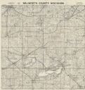
| Date: | 1896 |
|---|---|
| Description: | This late 19th century map of Walworth County, Wisconsin, shows the township and range grid, towns, sections, villages and post offices, roads, railroads, ... |

| Date: | 1977 |
|---|---|
| Description: | This 1977 map identifies the locations of 46 cemeteries in Calumet County, Wisconsin. Cemeteries are indexed by town. Also included are a civil town map, a... |

| Date: | 1878 |
|---|---|
| Description: | This map of Crawford County, Wisconsin, shows the township and range grid, sections, towns, cities and villages, land ownership and acreages, roads, railro... |

| Date: | 1862 |
|---|---|
| Description: | This map shows townships and sections, landownership and acreages, roads, railroads, cemeteries, churches, schools, mills, and stone quarries. "Engraved, p... |

| Date: | 1887 |
|---|---|
| Description: | This late 19th century map shows the lake region around Oconomowoc in Waukesha County and eastern Jefferson County, Wisconsin. Cities and villages, roads, ... |

| Date: | 1862 |
|---|---|
| Description: | This 1862 map of Winnebago County, Wisconsin, shows the township and range grid, towns, sections, cities and villages, railroads, roads, property owners an... |

| Date: | 1903 |
|---|---|
| Description: | Map of Brown County, Wisconsin, shows the township and range grid, towns, sections, cities, villages and post offices, land owners and acreages, railroads,... |

| Date: | 1914 |
|---|---|
| Description: | Map shows school houses, creameries, post offices, saw mills, grist mills, churches, cemeteries, town halls, stores, roads, state roads, and railroads. "Co... |

| Date: | 1929 |
|---|---|
| Description: | This 1929 topographic map of Trempealeau County, Wisconsin, shows the topography, lakes, streams and wetlands, township and range grid, sections, cities an... |

| Date: | 1928 |
|---|---|
| Description: | This 1928 topographic map of Vernon County, Wisconsin, shows relief, lakes, streams and wetlands, the township and range grid, sections, cities and village... |
| Date: | 1956 |
|---|---|
| Description: | Map shows townships and sections, landownership and acreages, roads, schools, churches, and cemeteries. |

| Date: | 1873 |
|---|---|
| Description: | This 1874 map of Washington and Ozaukee counties, Wisconsin, shows the township and range grid, towns, sections, cities and villages, rural landownership a... |

| Date: | 1874 |
|---|---|
| Description: | This 1873 map covers the northern halves (Towns 11 and 12) of Washington and Ozaukee counties. Shown are the township and range grid, towns, sections, citi... |
If you didn't find the material you searched for, our Library Reference Staff can help.
Call our reference desk at 608-264-6535 or email us at: