 Filter: Categories of Wisconsin Historical Images
Filter: Subject of Cemeteries
Filter: Type of Map or Atlas
Filter: Categories of Wisconsin Historical Images
Filter: Subject of Cemeteries
Filter: Type of Map or Atlas

| Date: | 1924 |
|---|---|
| Description: | This map shows streets, selected buildings, railroads, railway yards, schools, parks, schools, cemeteries, bays, the Milwaukee River, and Lake Michigan. De... |

| Date: | 1926 |
|---|---|
| Description: | This map shows streets, railroads, parks, and cemeteries. The top right includes an advertisement for Bartles-Maguire Oil Co. Wards are colored in red, yel... |

| Date: | 1927 |
|---|---|
| Description: | This map shows street car lines, bus routes, railroads, proposed city boundary lines, wards, public schools, blocks & house numbers, Lake Michigan, one mil... |
| Date: | 1929 |
|---|---|
| Description: | This map shows streets, railroads, parks, cemeteries, and a proposed harbor. The top margin includes an advertisement for Delco Motor Oil and the right mar... |

| Date: | 1930 |
|---|---|
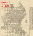
| Description: | This map shows streets, railways, bus lines, railroads, roads, parks, cemeteries, Lake Michigan, and a proposed harbor. Also included is a legend and on th... |

| Date: | 1974 |
|---|---|
| Description: | This map shows streets, Lake Winnebago, Little Lake Butte Des Morts, and the Fox River. Also included is text on the Fox River Waterways and the history of... |
| Date: | 1932 |
|---|---|
| Description: | This blue line print plat map shows local streets, numbered blocks and lots, village limits, and land ownership by name. Also included are manuscript annot... |

| Date: | 1894 |
|---|---|
| Description: | This map shows sewers, intercepting sewers, manholes, block numbers, streets, railroads, parks, cemeteries, and Lake Michigan. The right margin reads: "Tot... |

| Date: | 1896 |
|---|---|
| Description: | This map shows streets, wards, railroads, parks, cemeteries, and Lake Michigan. Also included are explanations and an index of points of interest. |

| Date: | 1897 |
|---|---|
| Description: | Two maps that show cemeteries, schools, engine houses, railroads, street railways, wards, roads, parks, block numbers, and Lake Michigan. One map has wards... |

| Date: | 1879 |
|---|---|
| Description: | This map shows asylums, cemeteries, hospitals, parks, streets, and wards. Relief is shown by contours. Also included are manuscript annotations in pencil. ... |

| Date: | 1890 |
|---|---|
| Description: | This map shows city wards, block numbers, parks, cemeteries, roads, railroads, and selected buildings. The map includes indexes to streets, public building... |

| Date: | 1860 |
|---|---|
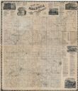
| Description: | This map shows roads, railroads, rivers, townships, school houses, churches, cemeteries, and land ownership by name. Relief is shown by hachures. The map i... |

| Date: | 01 1969 |
|---|---|
| Description: | A map of Oneida county, which includes a small drawing of a hodag. |

| Date: | 1888 |
|---|---|
| Description: | This map shows city wards, block numbers, parks, cemeteries, roads, railroads, and selected buildings. The map includes indexes to streets, public building... |

| Date: | 1877 |
|---|---|
| Description: | This map is a photstat copy of the original and shows landownership, townships and sections, wagon roads, railroads, school houses, churches, cemeteries, m... |
| Date: | 1874 |
|---|---|
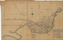
| Description: | This map shows townships and sections, land ownership and acreages, churches, schools, cemeteries, roads, railroads, and projected railroads. The map inclu... |

| Date: | 1912 |
|---|---|
| Description: | This blueprint manuscript map shows landownership, mills, railroad, churches, public buildings, the old cemetery, and the Chippewa River and Reservoir. The... |

| Date: | 1961 |
|---|---|
| Description: | This street map includes an ancillary map of Dane County highways and a business directory. Lake Mendota, Lake Monona, Monona Bay, Yahara River, and Lake W... |

| Date: | 1907 |
|---|---|
| Description: | This blueprint map shows a proposed plan for pleasure roads and reservation system. It also shows schools, cemeteries, old river channel, proposed bridge, ... |
If you didn't find the material you searched for, our Library Reference Staff can help.
Call our reference desk at 608-264-6535 or email us at: