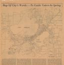
| Date: | 1961 |
|---|---|
| Description: | Shows wards and voting precincts. Published in The Capital times: January 28, 1961. |

| Date: | 1887 |
|---|---|
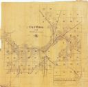
| Description: | City water works system map. Pencil annotation on the top right reads: "Period represented is after 1887 and before Aug. 1891". The middle of the map has a... |

| Date: | 1887 |
|---|---|
| Description: | Shows pipes of various sizes, hydrants with hydrant pressure, valves, wells, and projected lines. |

| Date: | 1855 |
|---|---|
| Description: | This bird's-eye-view map of Madison is looking north across Lake Monona. The map features two women and two men on a lookout on top of a building in the fo... |

| Date: | 1855 |
|---|---|
| Description: | This map shows a plat of the city, local streets, numbered blocks and lots, university grounds, the Capitol Square, and parts of Third and Fourth Lakes (La... |

| Date: | 1896 |
|---|---|
| Description: | This map shows a plat of the town, wards, buildings, the state capitol, local streets, railroads, and parts of Lake Mendota, Lake Monona, and Lake Wingra. ... |

| Date: | 1924 |
|---|---|
| Description: | Intended for tourists, this brochure, titled: "Plan Now to See Madison, The Four Lake City: "The City Built on an Isthmus," features a map of Madison and s... |

| Date: | 1921 |
|---|---|
| Description: | This map has labeled streets and points of interest. Lake Mendota and Lake Monona are labeled. The back of the map includes index of University of Wisconsi... |

| Date: | 1914 |
|---|---|
| Description: | This map shows a plat of the town, city limits, numbered blocks and lots, wards, local streets, roads, railroads, Capitol Square, Vilas Park, Edgewood Acad... |

| Date: | 1968 |
|---|---|
| Description: | This blue line print map shows proposed changes reserving railroad right-of-ways for future highways, land plots, as well as Lake Monona and Lake Mendota. |
If you didn't find the material you searched for, our Library Reference Staff can help.
Call our reference desk at 608-264-6535 or email us at: