 Filter: Categories of Wisconsin Historical Images
Filter: Subject of Camping
Filter: Year of 1900-1999
Filter: Categories of Wisconsin Historical Images
Filter: Subject of Camping
Filter: Year of 1900-1999

| Date: | 11 02 1961 |
|---|---|
| Description: | Betsy Silber and Ann Simmons are shown in lively conversation in their sleeping bags on the floor of the YWCA gym. Cold weather sent 49 girls inside for th... |

| Date: | 1926 |
|---|---|
| Description: | This brochure was intended for tourists and shows resorts, lakes and railroads in northwestern Wisconsin and part of Michigan’s upper peninsula. Also inclu... |

| Date: | 1950 |
|---|---|
| Description: | Margo Pirie and Sue Ann Hackett on an outdoor camping trip. They are seated near a campfire with a tent in the background. |

| Date: | 1950 |
|---|---|
| Description: | Sue Ann Hackett kneeling and holding a tin cup on an outdoor camping trip. There is a tarp in the foreground with dishes and food containers. Birch trees a... |
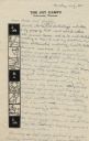
| Date: | 07 25 1949 |
|---|---|
| Description: | Letter from Sue Ann Hackett at Joy Camps in Hazelhurst, Wisconsin to her parents. The letter is written on Joy Camps stationery that includes line drawings... |

| Date: | 09 11 1964 |
|---|---|
| Description: | Boy Scout with backpack getting ready for a Camporee which will take place Oct. 2 - 4, 1964. |

| Date: | 1975 |
|---|---|
| Description: | This map shows boundaries, roads, national forest land, bogs and wetlands, lakes, campgrounds, and boat landings. |

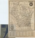
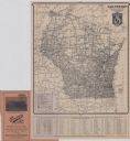
| Date: | 1962 |
|---|---|
| Description: | This map shows roads, golf courses, ski areas, boat landings, camp sites, waysides, parks, beaches, scenic views, virgin timber tracts, airports, boys and ... |

| Date: | 1962 |
|---|---|
| Description: | This map shows roads, golf courses, ski areas, boat landings, camp sites, waysides, parks, beaches, scenic views, virgin timber tracts, airports, boys and ... |

| Date: | 1990 |
|---|---|
| Description: | This map shows various types of trails, boat landings, canoe areas, public beaches, picnic areas, campgrounds, golf courses, public tennis courts, and othe... |

| Date: | 1980 |
|---|---|
| Description: | This map shows the locations of 42 businesses, roads, points of interest, recreation sites, camping, the North Country Trail and parking, and boundaries of... |
| Date: | 1923 |
|---|---|
| Description: | This map shows road surfacing, cities, rivers, towns, roads, highways, and camp sites. Included are portions of Minnesota, Iowa, Illinois, and Michigan. La... |

| Date: | 1960 |
|---|---|
| Description: | This pictorial map shows recreation activities, rivers, lakes, and the history of the area. The map covers Langlade County and parts of adjacent counties. ... |
| Date: | 1924 |
|---|---|
| Description: | This map shows road surfacings, camp sites, state parks, proposed state parks, rivers, lakes, towns, and county boundaries. Includes a legend of road surfa... |

| Date: | 1925 |
|---|---|
| Description: | This map shows road surfacing, camp sites, rivers, lakes, county boundaries, and cities. Original caption reads, "Compliments Hotel Witter Tour Information... |

| Date: | 1926 |
|---|---|
| Description: | This map shows road surfacings, camp sites, state parks, proposed state parks, rivers, lakes, county boundaries, and cities. Includes portions of Minnesota... |

| Date: | 1966 |
|---|---|
| Description: | This map includes a red overprint on base map and shows the supervisors and district numbers of St. Croix County. Includes diagrams of civil towns, townsh... |

| Date: | 1955 |
|---|---|
| Description: | This map shows roads, golf courses, airports, fire towers, schools, camp grounds, rivers, streams, lakes, and railroads. The right margin of the map includ... |

| Date: | 1930 |
|---|---|
| Description: | This map shows roads and lakes and includes an inset illustration of Manitowish Waters Fish Hatchery. The back of the map includes a resorts directory, tex... |

| Date: | 1943 |
|---|---|
| Description: | This map shows roads, trails, taverns, schools, golf, gas stations, campsites, resorts, and towers. The lower left of the map includes a legend. The map co... |
If you didn't find the material you searched for, our Library Reference Staff can help.
Call our reference desk at 608-264-6535 or email us at: