 Filter: Categories of Wisconsin Historical Images
Filter: Subject of Business
Filter: Categories of Wisconsin Historical Images
Filter: Subject of Business

| Date: | 1932 |
|---|---|
| Description: | This map of Granville shows streets, businesses, residential areas, schools, golf courses, and industrial areas. The map shows Granville in March of 1932. ... |
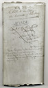
| Date: | 1852 |
|---|---|
| Description: | Assembly bill 175 which legalized the business of banking in Wisconsin. |
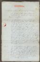
| Date: | 1852 |
|---|---|
| Description: | First page of Assembly Bill 175 approving the business of banking in Wisconsin. |

| Date: | 01 19 1960 |
|---|---|
| Description: | Eva Brewster (left), Madison United Church Women president; Ellis Dana, council executive vice-president; and Christina Dana discuss council changes. |

| Date: | 1954 |
|---|---|
| Description: | This map of La Crosse shows residential, multiple dwelling, local business, commercial, light industrial, heavy industrial and special multiple dwelling la... |

| Date: | 1915 |
|---|---|
| Description: | This map shows a plat of city, wards, sections, land ownership by name, local streets, roads, railroads, local businesses, schools, and parks. This map is ... |
| Date: | 1925 |
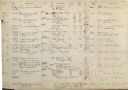
|---|---|
| Description: | This page from a stock book from Ferdinand Hotz's Chicago based jewelry business shows his inventory of gemstones, his costs, and the clients who bought th... |

| Date: | 1875 |
|---|---|
| Description: | This map shows land ownership by name, plat of town, local streets, fairgrounds, part of White and Fox Rivers. The map includes illustrations of buildings ... |

| Date: | 1964 |
|---|---|
| Description: | This map is a hand-colored blue line print and shows 4 residence zones, 2 business zones, 1 light manufacturing zones, schools, and parks. The zones are ou... |

| Date: | 1975 |
|---|---|
| Description: | This map shows plat of the city, city limits, local streets, and part of Baraboo River. The map includes 2 inset maps and a legend showing residential, bus... |

| Date: | 11 01 1960 |
|---|---|
| Description: | Shown in center is Major Alexander P. de Seversky, pioneer in aeronautical design and engineering, and speaker at the Air Power banquet at the Wisconsin Me... |

| Date: | |
|---|---|
| Description: | Josh Sanford, an unknown individual, and Willis Hofmeister, at Willis's Radio and Electric Service. Sanford served in the Air Force during World War II as ... |

| Date: | 02 11 1961 |
|---|---|
| Description: | Ninety-two foreign students attending the U.W., Beloit, and Milton Colleges representing 35 countries took buses to Janesville where they were guests of th... |

| Date: | 04 25 1961 |
|---|---|
| Description: | Chief No-Ha-Nutch'Ka,left, who is actually Jack Grey, head of public relations for Wisconsin Dells, gives Chamber of Commerce members tips on how to gain m... |
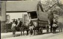
| Date: | |
|---|---|
| Description: | John Hahn stands in the street near his horse-drawn cart. The side of the cart says 'John Hahn Piano & Furniture Moving'. The cart, John Hahn, and the cart... |

| Date: | 1876 |
|---|---|
| Description: | A hand-colored map on six sheets, this map of Juneau County indicates the locations of townships and sections, landowners and acreages, roads, wagon roads,... |

| Date: | 1956 |
|---|---|
| Description: | Intended for tourists, this brochure features a map of Milwaukee's central business district as well as general information about parking, beaches and othe... |

| Date: | 1917 |
|---|---|
| Description: | This map shows streets, land owners, local businesses, the St. Louis River, and bridges. The maps reads: "Incorporated 1917." The back of the map includes ... |

| Date: | 1910 |
|---|---|
| Description: | This map is a survey of Kenosha Harbor and shows local streets, public buildings, local businesses, and part of Lake Michigan. Included is text on sailing ... |

| Date: | 1855 |
|---|---|
| Description: | This map shows lot and block numbers, buildings, some landownership, roads, railroads, cemeteries, the Milwaukee River, and Lake Michigan. The map includes... |
If you didn't find the material you searched for, our Library Reference Staff can help.
Call our reference desk at 608-264-6535 or email us at: